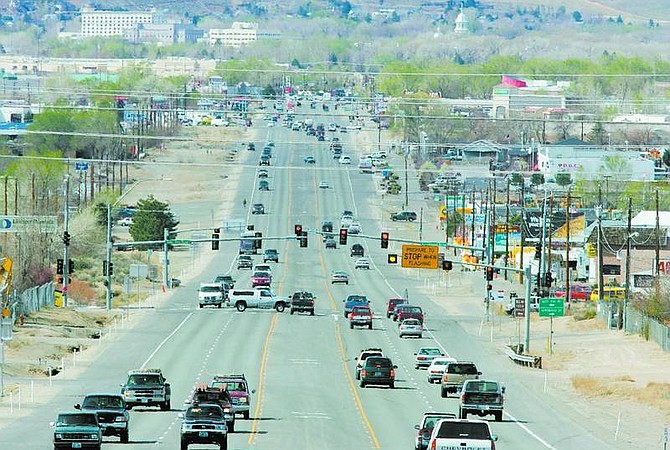
BRAD HORN/Nevada Appeal The Nevada Department of Transportation ran bus tours along Highway 50 between Carson City and the junction with Highway 50A on Saturday as a way to get feedback from area residents about their concerns with the highway's increased traffic.
Change is coming, and the Nevada Department of Transportation wants to be prepared for it.
That was the overriding message from the bus tours along Highway 50 on Saturday. NDOT offered the tours, which covered an area from Carson City to the junction with Highway 50A, as a way to get feedback from the people who know the highway best.
The transportation department is nearing completion of a two-year study done by PBS&J consultants in Reno on transportation alternatives for a 52-mile stretch of the Highway 50 corridor, from Carson City to the Leeteville Junction in Churchill County.
Saturday's tours allowed the department to share several proposed changes and hear residents' concerns before the final report is released next month.
The goal of the study is to look at how the area is growing and what it's going to look like, then attempt to plan what needs to be done to the corridor as a result of those changes, according to Bryan Gant, project manager for PBS&J.
"This area is changing quite a bit," said Gant. "What you have is a lot of travel on a state and regional level using the corridor but it is also people's driveways and the only access to their community."
One of the main components NDOT is hoping to utilize is access management, limiting the number and location of access points to the highway to improve safety and traffic flow.
"We know that it's going to be a challenge to convince businesses and homes that we need limited access onto Highway 50," said Sandi Stanio, NDOT program coordinator. "But it really can be beneficial."
One of the areas that would be most affected by this proposed change is in Mound House, where businesses have multiple driveways directly onto Highway 50.
The study also identifies about 13 intersections where some type of control is being considered, ranging from dedicated turn lanes to traffic signals. The department perceives that many of those intersections will see increased usage because of currently proposed developments.
One of the intersections where a signal is being considered is Highway 50 at State Route 341 to Virginia City.
Stanio said four other options are evaluated before the department looks at putting in a new signal: A dedicated turn lane, a dedicated acceleration lane, a signalized acceleration lane similar to the one at Johnson Lane and Highway 395 in Douglas County, and a high-speed roundabout.
"We consider those options before a signal because signals can cause more accidents than they can solve," Stanio said.
Dayton resident Bob Wallace said that while he doesn't want a lot of signals on the highway, he understands they are becoming necessary.
"At some point they are going to have to put some up," Wallace said. "They are going to have to provide some relief at these intersections."
When the study was commissioned, there were seven developments with direct impacts on the highway. That number has since increased to 12.
Jeannette Wright, a Mound House resident, said several of the intersections in her area are dangerous, and she would like to see signals, especially at Red Rock Road and Highlands Drive.
"We just want to see it become safe because they don't go 45 in the 45 mph zone. It's the kamikaze approach to a highway," Wright said.
Stanio said that many of the recommendations are more minor things, such as striping and informational signs that will affect the highway, including Roadway Weather Information Systems.
The weather information system takes the temperature of the road and when it approaches freezing, notifies crews to take preventative measures to keep the road safe and useable.
The study includes proposed additions and changes from now until 2035.
• Contact reporter Jarid Shipley at jshipley@nevadaappeal.com or 881-1217.
Controlled intersections
These intersections along the Highway 50 corridor are identified as controlled intersections by the Nevada Department of Transportation. Being classified as controlled intersections means NDOT is considering putting in various changes including dedicated turn or acceleration lanes, roundabouts or traffic signals.
Carson City
• Nye Lane
Mound House
• Newman Lane
• State Route 341 to Virginia City
Dayton
• Pinecone Road
• Right turn only at Smith's Shopping Center
• Fortune Drive
• Segale Road
• Graves Drive
• Cardelli Road/Riverboat Road (near proposed second county bridge over Carson River)
• Six Mile Canyon Road/Ft. Churchill Road
• Mark Twain Avenue
• Pinenut Road
• Chaves Road
Stagecoach
• Boyer Lane
Silver Springs
• A proposed roundabout at Highway 50 and Highway 95A

Comments
Use the comment form below to begin a discussion about this content.
Sign in to comment