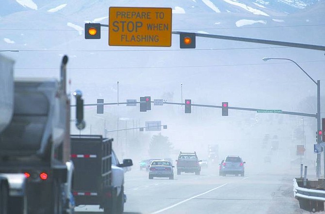
Traffic on Highway 50 East at Arrowhead Drive is seen through the dust and debris kicked up as high winds blew through Northern Nevada on Wednesday. Cathleen Allison/ Nevada Appeal
As hurricane-force gusts blew through Carson City and the Washoe Valley on Wednesday, conspicuously absent were the storm clouds once predicted to accompany them.
This storm system, touted last week as an elixir to prevent this month from becoming the driest March in more than a decade, should creep in and out of Northern Nevada by Sunday leaving little or no precipitation in its wake, meteorologists said this week.
"Unfortunately, (the storm's) mostly going to move to the north of us here," said National Weather Service National Weather Service Meteorologist Jim Wallmann, who is based in Reno. "There might be more wind than snowfall. And probably nothing in the Reno/Carson areas.
"Sprinkles down here, and maybe an inch (of snow) at best up top."
That March was such a bust weatherwise is not good news, said Federal Water Master Garry Stone.
"It's looking a little bleak at this time," he said. "The (precipitation) dropped off early this month - it really hurts."
To date, only seven-tenths of an inch of precipitation has dropped near the Reno weather substation this month.
An average March features 7.72 inches.
That puts the month at 10 percent of normal, meteorologist Wallmann said.
This could portend bad things for the region's reservoir level and water supply, said Chad Blanchard, chief hydrologist for the U.S. District Court Water Master.
"When April hits, we'll be hoping for a storm or two," he said.
"Pray for snow," Stone added.
But it looks like the die is already cast, weather experts said.
"We could get some (storms) in early April, but nothing's showing up too promising," Wallmann said.
Stone admitted the disappointing March put a "major damper on things."
Indeed, if the spring weather holds through April, water trackers said they'll start to look at how to deal with potential water shortages this summer.
"The carry-over water storage isn't all that great because of last year's drought year," Blanchard said. "We dipped way into our storage just to meet minimum flows. All precipitation that has fallen has been snow. We had early storms, but it hasn't been the wettest year.
"The run-off or (lack thereof) will reflect that."
Dan Greenlee, a hydrologist for Natural Resources Conservation Services office in Reno, said he was busy this week preparing for his agency's annual snowpack report - to be released April 1.
"March was a very big disappointment as far as a snowstorm," he said. "Pretty much nonexistent this month.
"Just looking at the data, we're below, to well-below average. That's exactly what I thought would happen. We were looking good for a month or two before the bottom fell out."
How bad is it? Stone was loathe to come out with a concrete prediction until the April 1 report is released, but preliminary numbers show that a dry March has had a significant negative impact, he said.
After water levels were recorded at an average of 110 percent of average at the beginning of the month, they're now well-below.
The Truckee River is 87 percent of average basin-wide, Lake Tahoe is 91 percent of average and the Carson River is 89 percent of average.
"It dropped off considerably this month," Stone said. "It really hurts."
The snowpack should measure between 79-85 percent of average, Stone predicted.
At the beginning of March, snowpack was estimated at 110 percent of normal.
As far as water supply goes, if things stay status quo, residents will see a drop-off, but now's not the time to panic hydrologist Greenlee said.
"They're going to be a little short in the Lahontan reservoir," he said, adding that repairs to the Fernley portion of the canal, damaged in the new year's floods, were complete Saturday. The canal will flow at its average rate of 150 cubic feet per second. This, he said, is good news for Northern Nevada's thirsty farmlands.
The Carson River will also continue to dwindle, though it's predicted to flow at about 90 percent of average most of the summer. Lake Tahoe will rise about 1.3 feet and top off at 94 percent of average when the snow melts.
On the other side of the Sierra crest, Sierra snowmelt provides more than a third of California's drinking and irrigation water and helps maintain the State Water Project, which provides water to more than 23 million people and 775,000 acres of farmland.
Although things "could've been a little better," Greenlee said this winter could've been worse.
"I think after a fast start we were hoping for a lot," he said. "We're below average, but it's not a worst-case."

Comments
Use the comment form below to begin a discussion about this content.
Sign in to comment