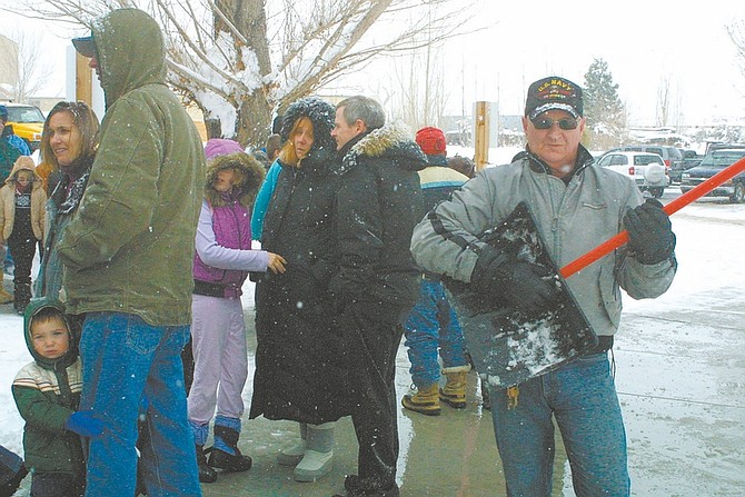
Sandi Hoover/Nevada Appeal Jim Fitzgerald, groundskeeper at the Nevada State Train Museum, takes a break from shoveling snow Saturday afternoon to a strike a pose as a guitar player. Everyone seemed to be in high spirits while waiting to ride the Santa Train.
The leading edge of a powerful Pacific storm is moving into the region this afternoon and tonight, according to meteorologist Scott McGuire, of the National Weather Service in Reno.
The storm promises to bring abundant moisture and snow to the Sierra and western Nevada.
In the valleys, the storm is expected to dump 5-10 inches of snow.
One to two feet of snow is expected in the mountains at lake level and two-four feet above 7,000 feet.
"This is a big storm stretching from Oregon to Southern California. There are already flood warnings in LA," McGuire said.
"This is a classic winter storm with extremely heavy snowfall. We were behind in our snowpack but with these past three systems, we're catching up pretty fast," he said. "It's an early Christmas present for the ski resorts."
A number of non-injury snow-related accidents were reported Saturday, including a four-car pileup in front of Carson Station.
Snow will continue to fall throughout the night with the heaviest snowfall before midnight, he said, and tapering into lighter snow showers throughout Sunday morning.
"Visibility will be greatly reduced on roads, and I would expect a lot of our major roadways will be closed for some time tonight," he said. "If you don't have to go anywhere, stay home."
Overnight lows are expected to hover around 26 degrees with a high Sunday of 38 degrees.
"The cloud cover acts as a blanket to keep things relatively warm," McGuire said.
The National Weather Service issued a winter storm watch through Sunday evening for western Plumas County and the west slope of the Sierra Nevada in the north and the mountains of Ventura and Los Angeles counties in the south.
"It looks like we'll be getting a lot of precipitation," said George Cline, a National Weather Service forecaster in Sacramento.
He expected the storm to bring an inch of rain to the Central Valley, with wind gusts up to 60 mph. Gusts up to 90 mph were expected on mountain ridges.
The California Department of Transportation was requiring chains for travel on all major highways over the Sierra. Chains were also required for Interstate 80 through most of Nevada.
Forecasters were warning of whiteout conditions, with snow expected to fall up to two inches an hour at the peak of the storm. They said the new snow would also bring extreme avalanche danger to the alpine backcountry.
The storm was expected to leave more than a foot of new snow at lower elevations and two feet in higher areas in the northern Sierra. Snow was expected as low as 5,000 feet.
The new snow was piling on top of powder left by two earlier storms in recent days, bringing smiles to skiers.
Boreal ski area atop Donner Summit was reporting 15 inches of new snow Saturday, before the new storm. Squaw Valley USA, just north of Lake Tahoe, reported up to 10 inches of new snow, while nearby Alpine Meadows reported up to 20 inches.
To the south, snow accumulations between 8 and 16 inches were expected by Sunday morning above 6,000 feet in the Southern California mountains. Sustained winds of 25 to 35 mph with gusts to 50 mph were expected.
The National Weather Service posted a flash flood watch for parts of Southern California as moderate-to-heavy showers and thunderstorms came ashore. Residents of Southern California foothill communities near the slopes scorched by fires were urged to be on guard for possible mud and debris flows.
Rain could fall at rates up to three-quarters of an inch per hour through early Sunday. Forecasters said that could bring a threat of flash floods and debris flows in areas that have been burned by wildfire. Major canyon roads through the burn areas remained closed.
The burned hills above a La Crescenta neighborhood let loose a thick layer of debris Saturday afternoon, leaving a residential road covered in dirt, rocks and roots. No damage to homes or injuries were reported.
Near the Hollywood Bowl in Los Angeles, a family decided to evacuate a home in a neighborhood where rain threatened to bring mud and debris down the hillside. A city building inspector put a yellow tag on the house, advising residents of potential structural problems.
Nearly 5,000 utility customers throughout Los Angeles were sporadically without electricity, mostly because of downed branches crashing onto power lines.
A Los Angeles-area thoroughfare was briefly closed Saturday morning after mud and rocks slid down a hillside into lanes. Several cars had their tires flattened by sharp rocks along Topanga Canyon Boulevard. No injuries were reported.
Cline said most soils in the northern part of the state aren't saturated this early in the winter, minimizing the danger of mudslides even in burned areas.
"We don't anticipate anything really unusual from it yet," Cline said. "We're keeping an eye on the burn scar areas. Things have been so dry, it's still soaking into the ground."
Saturday's storm is the second in a series of warmer, wetter storms blowing in from the mid-Pacific Ocean. Another similar story is expected to move in by midweek, Cline said.
--The Associated Press contributed to this story

Comments
Use the comment form below to begin a discussion about this content.
Sign in to comment