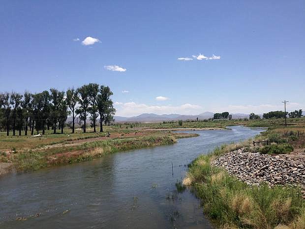
View of the Humboldt River near Beowawe, another of the exits with a story found along Interstate 80.
This week we are concluding our search for the meaning behind Interstate 80’s more obscure roadside exits.
About six miles from Valmy is the Mote interchange. What you see is basically what there is to Mote. Nothing. Originally designated as a railroad siding, that’s all it has ever been.
Next up is Battle Mountain located 10 miles east of Mote. This small community is named after a nearby bluff that was the site of a mid-19th century skirmish between native Shoshone warriors and a wagon party on the Emigrant Trail or — goes another story— — for an Indian raid on a road-building crew.
Miners settled the area in 1867 after the discovery of substantial silver, copper and gold deposits. The present Battle Mountain site was developed in the late 1860s as a railroad station.
Today, Battle Mountain is fairly good-sized community that serves as the seat of Lander County.
About 13 miles from Battle Mountain is the Argenta exit, a railroad siding established in the 1860s. The name, which is derived from the Spanish word for silver, also applied to a nearby mining camp which, in 1870, was picked up and moved to Battle Mountain.
Ten miles from Argenta is Dunphy, a rail siding named after a nearby ranch.
The next noteworthy exit is Beowawe, located 7 miles from Dunphy. Beowawe is a tiny ranching community that sits about six miles south of the interstate on northern lip of the beautiful Crescent Valley.
There are several stories behind the town’s unusual name. One is that it derives from Northern Paiute word for “gate” or “opening” which roughly describes the area’s geographic configuration in relation to the surrounding mountains. Another story is that the name means “great posterior” and was first used when a local tribe was frightened by the presence of a particularly large railroad manager.
About seven miles west of Beowawe are the remnants of the Beowawe geysers. Once a famous roadside landmark, this cluster of geysers, one of which reportedly rose more than 30 feet high, faded by the early 1960s as a result of the local geothermal water being diverted for a nearby powerplant.
Four miles south of Beowawe is Gravelly Ford, an important Emigrant Trail crossing. This was also the site of one of the early tragedies of the infamous Donner Party. Here, James Reed, killed another member of the group, John Snyder, during an argument. Reed was banished from the group.
Ten miles from the Beowawe interchange is the Palisade exit. From here, travelers with four-wheel drive vehicles can head 10 miles south to the Palisades, a 12-mile canyon with spectacular rock cliffs split by the Humboldt River.
Additionally, you pass through the ruins of Palisade, a former railroad town on the river that served as the connecting point for the Southern Pacific Railroad and the Eureka and Palisade Railroad
Carlin, located 10 miles east of the Palisade exit, began life in 1868 as a railroad town. The town’s name commemorates William Passmore Carlin, a Union officer.
As with most railtowns, Carlin’s original commercial district—most of which is defunct but still standing—was built along the tracks, located a mile south of the interstate. There is also an impressive, old wooden church now padlocked.
Despite the rundown downtown, the rest of Carlin is booming as a result of the town’s location near the Newmont gold mine, one of the largest in the world. Several newer restaurants and businesses are located adjacent to the interstate.
About seven miles from Carlin are the Carlin Tunnels, two 1,900 foot auto tunnels carved through the Adobe Range. Built in 1974 at a cost of $8 million, these passages, and those at Cave Rock, are the only car tunnels in Nevada.
As you drive toward Elko, the next community, notice the magnificent stone pillars or hoodoos located along the interstate. These unusual rock spires were formed by erosion.
From Elko, the Interstate continues on to the town of Wells and along the way passes a handful of other nearly forgotten exits, including: Halleck, named for Camp Halleck, a 1860s fort once located 12 miles south of the highway; Deeth, a small ranching community that was once a railroad station; and Oasis, a roadside stop named after a local ranch.
From Oasis, it’s mostly a straight shot to Wendover, the last Nevada stop before entering Utah, which has its own share of exits to nowhere.
Rich Moreno covers the places and people that make Nevada special.

Comments
Use the comment form below to begin a discussion about this content.
Sign in to comment