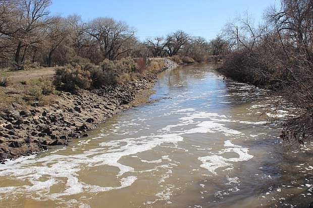
Water flows east of Diversion Dam on Sunday.
Crews from both the county and Truckee-Carson Irrigation District have been working feverishly this week cleaning out the Carson River channel and assessing any potential flooding due to changing weather patterns.
Rusty Jardine, TCID’s executive director, reviewed the water situations not only in the Lahontan Valley but also in the Sierra Nevada range. TCID began releasing water from Lahontan Dam on Saturday to reduce storage because of the runoff coming down the Carson River from the Sierra. As the reservoir takes on more water from the Carson River, TCID has not diverted water from the Truckee River via the Truckee Canal through the Fernley area and into the reservoir.
“On Wednesday the river is flowing as high as 1,000 cfs (cubic feet per second) below Diversion Dam and 1,200 cfs by the end of the week.” Jardine said. “By March 15, the river’s cfs could be flowing at 2,200.”
Once the crews clear the channels, Jardine said the river flow will be increased.
“That is our desired goal,” Jardine told commissioners. “We’ll ramp the flow as high as we can without causing damage.”
Commissioners are strongly urging property owners and others that if they see eddyies, ponds or drains coming off the river and filling up with water, they must call the Churchill County Sheriff’s Office (775-423-3118) or TCID (775-423-2141) immediately, not later.
Commissioner Pete Olsen reiterated flows will be increasing in the river on a daily basis, and residents should expect higher flows than normal. He said agencies will monitor the river to ensure safety. Because of the increased flows, Olsen said the south crossing at Diversion Dam will be inaccessible because of higher river flows, and residents must find an alternate route. He said this could last for months.
Local government agencies involved with emergency operations have begun meeting. The Local Emergency Planning Committee (LEPC) will coordinate efforts with emergency planners, government agencies and law enforcement and develop a central clearinghouse of information to the public.
Churchill County Sheriff Ben Totter and his office have been providing notices to people who live near the Carson River and what they must do to mitigate any hazards that could lead to flooding. Furthermore, LEPC uses FEMA (Federal Emergency Management Agency) maps to recognize and verify areas of concern. Olsen added the county will have information next week on sandbag procedures and how to distribute sandbags to residents affected by the rising water.
While crews have been ensuring the Carson River can handle the increased water and not have obstacles hinder the flow, Jardine said TCID has been checking bridges and canals in its system. Originally, Terry Edwards of the Bureau of Reclamation said the plan was to release water early this week from the reservoir, but the warmer weather and rain last week prompted officials to release water downstream earlier than expected.
For those who remember the flood of 1983, the current conditions could cause flooding in the lower areas of the Carson River, especially east of Fallon near Bafford Lane and heading out to the Carson Sink. Without flood controls and the lack of the Newlands Project in 1908, more than 3 feet of water inundated the downtown part of sparsely-settled Fallon with water lapping up on the stairs of the courthouse.
Whether it’s 1908, 1983 or 2017, TCID will have an enormous amount of water to move through the valley. Jardine said the snowpack in the Sierra has enough moisture to fill another Lahontan-sized reservoir, maybe two.
Shane Coors, a water consultant for the Bureau of Reclamation, reviewed three different scenarios with county commissioners. He gave a historical account of the three previous flooding years and 2017. From an April-June timeframe, he said the Carson River will run high as will the runoff to the reservoir.
“It’s time to act, and if we wait, it will be another 1983,” he said.
In showing the models, Coors said Scenario 2 appears be the preferred one because of the steady ramp-up with the flow of water, and it would be more successful to operate.
“Based on the models, this one pushes the river as hard as we can,” he said. “It’s our best choice.”
The model also shows how much easier it would be to move the water to the Carson Sink and away from incorporated areas.

Comments
Use the comment form below to begin a discussion about this content.
Sign in to comment