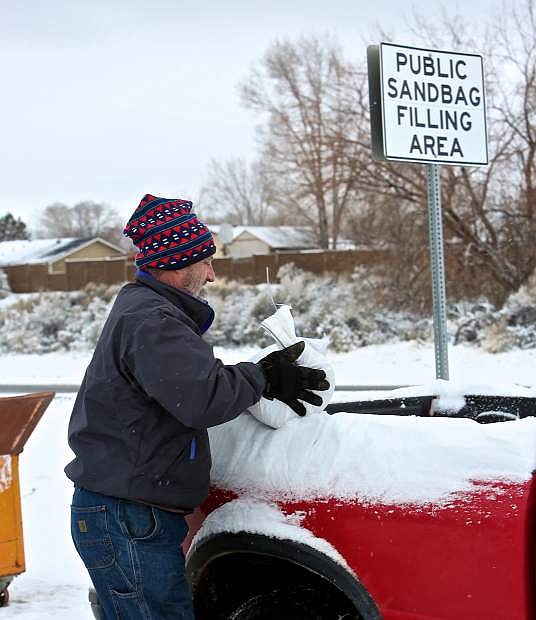
Tod Jennings of Carson City loads a sand bag into his truck to take to a Winnie Lane location.
A number to enter into your cell phones: A non-emergency flood hotline is at 887-2355 for all calls and questions that are non-life threatening emergencies.
•••
A message from Carson City about preparing for the potential flood:
•••
Here's a list of Douglas County sandbag fill locations:
Sheridan Fire Station East Fork Fire District Warehouse
980 Sheridan Lane 941 Mitch Drive Genoa Fire Station Zephyr Cove Park 2298 Main Street Hwy 50/Warrier Way Jacks Valley Fire Station Fish Springs Fire Station 3450 Jacks Valley Road 2249 Fish Springs Road Ruhenstroth Fire Station Johnson Lane Fire Station 2008 Pinto Circle 1450 Stephanie Lane Topaz Ranch Estates Community Center 4001 Carter Drive ••• Waste Management is warning its area customers of a possible impact to trash and recycling collection. Roads that are flooded by storm water or made narrow by ice and snow can be difficult for large collection trucks to safely negotiate. In an effort to reduce storm related collection delays in the future, WM is currently implementing a reroute for it's 3,000 customers in Reno, Sparks, Carson City, Washoe Valley, Dayton and Mound House. If a collection truck is unable to service your neighborhood due to storm conditions, WM will provide free extra pick up the following week with the return of normal weather conditions and service. Please put bagged excess trash and recycling next to the corresponding cart on your next collection day. Extra Waste stickers will not be necessary for collection of that additional trash. Despite the coming storm, the new routes will start next week. Starting January 9th, 2017 customers can use Pick Up Day Tool, a new online app to check trash and recycling schedules. The tool is located at Reno.WM.com – you do not have to be a Reno Resident to find your schedule.•••
Starting at noon today, do-it-yourself sandbag filling stations will be available at the 3rd Street parking lot off of Curry Street, Fire Station 52 on College Parkway, Ross Gold Park at Snyder Avenue, Ormsby Boulevard and W. Washington Street, Winnie Lane and Foothill Drive, and the Carson City Corporate yard at Public Works on Butti Way. Bring your own shovel.
A non-emergency flood hotline has been established for citizens to call during the storm event. The phone number is 887-2355 and is for all flood calls and questions that are non-life threatening emergencies.
•••
9:30 a.m. Friday morning: This story is updated to show a revised estimations for the Carson River.
According to the National Weather Service of Reno, the river is expected to hit flood stage, which is 10 feet, by late Sunday.
Currently, water levels are only at 3.86 feet as of Friday morning. The Carson River crests at 8 feet, and the NWS predicts the river will crest at 11.3 feet mid-Monday, the largest crest since December 2005. 11.3 feet would result in major flooding.
•••
Carson City officials are asking residents in flood prone areas to use the break in the weather to prepare for this weekend’s upcoming storm.
Rainfall totals of six to 12 inches are possible around the Tahoe Basin and in the Carson Range with up to three inches of rain in the lower elevations around Reno-Sparks, Carson City and Douglas County, the NWS flood alert says.
“Meteorologists are making the comparison because of the heavy snowfall and considerable snowpack in December 1996, which came before the 1997 ‘Pineapple Express’ or atmospheric river between December 30 and New Year’s 1997,” said Stacey Belt, Carson City deputy emergency manager, on Wednesday. “That rainfall in the mountains brought a lot of water down causing flooding across western Nevada. If predictions are accurate and the snow level is between 9,000 and 10,000 feet this coming Saturday, it’s a lot of moisture on top of the snowpack and it has to go somewhere.”
A storm expected this weekend is being compared to the 1997 storm that caused extensive flooding throughout western Nevada when warm rains melted the Sierra Nevada snowpack.
A flood watch is in effect from 4 a.m. Sunday until 8 a.m. Monday throughout the area, including in Carson City, Reno, Gardnerville, Virginia City and Stateline, according to the National Weather Service (NWS). Areas along the Carson River may be at a higher risk, as the water is expected to be higher than projected levels, creating concern for the Emergency Management. According to the National Weather Service of Reno, the river is expected to hit flood stage, which is 10 feet, by 4 p.m. Monday. Currently, water levels are only at 4.84 feet as of Thursday afternoon. The Carson River crests at 8 feet, and the NWS predicts the river will crest at 11.3 feet mid-Monday, the largest crest since December 2005.

“We are preparing for catastrophic torrential rains to start Saturday,” said emergency manager and Carson Fire Chief Bob Schreihans.
To prepare for the impending storm, Schreihans and Belt have initiated the Emergency Operations Center to begin their emergency management plan with the other Carson agencies in case the expected flooding occurs. Schreihans said they have also been working with other local agencies such as Nevada Division of Forestry to bring in additional crews to help with sandbagging and other flood-related activities.
“We are planning for the worst, but hoping for the best,” Schreihans said.
One of the worst case scenarios they’re planning for is a loss of power once flooding starts.
“Make sure your mobile phones are charged, you have plenty of bottled water and are prepared with food to get you through because it could be a couple of days before the power would be restored,” Schreihans said. “People need to consider for emergency preparation, that they need to survive on their own.”
There will be emergency services still available, however, calls will be redirected to the Emergency Operations Center where they will prioritize and allocate resources to the most necessary calls. Schreihans said incidents where life safety is at risk will take precedence over property or building loss. The Emergency Operations Center will be at Station 51. Schreihans asks residents to only use 911 for emergencies during flooding, flood information and help can be reached at the 211 number.
Schreihans also said all residents should be prepared for flooding, not just those next to river beds. Because much of the flooding may come from run-off from the mountains, flooding could be wide spread.
In preparation for the flooding, the Carson City Board of Supervisors signed a resolution declaring a state of emergency. This is based on the dollar amount of damage sustained during a crisis, which will make available additional funding and state resources to help during and after a catastrophe hits.
The resolution was brought to board in advance because the board was already assembled at the first of its two monthly meetings. The resolution won’t be submitted to the state until if and when the city spends $193,459 on supplies, equipment and personnel, the threshold for asking for assistance from the state, said Belt.
As of now, the city is preparing for the worst case scenario and to lessen potential damage. Belt and Schriehans, with other Carson agencies, have developed plans for evacuation centers if needed, emergency response and have began filling sandbags for residents to use to lessen flooding around their homes and businesses.
The city has filled nearly 20,000 bags for residents and people are encouraged to come and fill their own in preparation. Sandbags are available at the Public Works corporate yard at 3505 Butti Way, between the Public Works building and Parks Department entrance.
If flooding does occur, the Emergency Operations Center will announce a number for residents to call if they believe flooding levels are unsafe in their area. There will be a special team assigned to go out and assess properties to make sure there’s no risk to life and evaluate what the residents should do from that point on.
The Fire Department and Carson City government will put out a public safety announcement today on their websites, Facebook pages and Twitter pages informing residents of important numbers and what to do in the event of a flood.
For more information on flood preparation visit www.floodsmart.gov/floodsmart/, carson.org and http://carson.org/government/departments-a-f/fire-department. Information on the state of the Carson River can also be found at http://water.weather.gov/ahps2/hydrograph.php?wfo=rev&gage=STWN2.
Lindsay Chichester, extension educator with University of Nevada Cooperative Extension, offers this tips to prepare for a potential flood. To read more go here
BEFORE A FLOOD:
Water: At least a three-day supply (one gallon per person per day and extra if you have pets)
Food: At least a three-day supply of non-perishable, easy-to-prepare foods
Medications: At least a seven-day supply
Medical items: Hearing aids and batteries, glasses, contact lenses, syringes, canes or other walking assistance tools, items for people with disabilities
First aid kit
Flashlight with extra batteries
Rubber boots and rubber gloves
Copies of personal documents (medication lists, important medical information, deed/lease to home, birth and/or marriage certificates, insurance policies, etc.)
Cell phones and chargers
Family and emergency contact information
Extra cash
Extra blankets, clothing, and shoes
Baby supplies (bottles, formula, baby food, diapers)
Pet supplies (collar, leash, ID, food, water, carrier, bowl, blankets, toys)
Extra sets of vehicle and house keys
Priceless items or valuables
Rain gear
Camera for photos of damage
A NOAA weather radio which receives broadcast alerts directly from the National Weather Service
DURING A FLOOD:
Listen to the TV and/or radio for flood warnings and reports of flooding
Be prepared in case there’s a power outage, have electronic devices charged
Take advantage of sandbags if your home/business is in a flood prone area — be prepared, as these take longer to fill than you might think
If you have a basement, make sure your sump pump is working, consider a backup battery operated one if necessary
Clear debris from gutters or downspouts
Cautiously clear small items out of waterways, anything bigger than a tumbleweed should be removed by an emergency service person
Anchor any fuel tanks and outdoor furniture
Move important documents and valuables to a safe place
Be prepared to evacuate at a moment’s notice
When a flood or flash flood warning is issued for your area, head for higher ground and stay there
Don’t try to walk in flood waters, just six inches is enough to knock you down
Don’t try to cross a flooded road, turn around and find an alternative route. Most cars can be swept away by less than two feet of water
Keep children out of the water
Be especially cautious at night when it’s harder to recognize potential dangers
Know your evacuation routes (several may need to be identified) and have a place to stay
Ensure your vehicle has a full tank of gas and is ready to go if you need to leave an area quickly
If you don’t have a place to go, contact the city to determine where evacuation shelters are located
Establish a communication plan with family — determine ahead of time where you will meet or go if you should get separated
Use text messaging or social media to let friends and family know you’re safe
If you should happen to get trapped in a building, vehicle, or outdoors during a flood, get to the highest spot you can and try to signal or call for help.
AFTER A FLOOD:
Only return home when officials have declared the area safe
Shut off utilities until it can be determined they don’t pose a risk
Use flashlights, not lanterns, torches, or matches to examine buildings, as open flames may cause a fire or explosion if gases have been leaking
Before entering your home, look for loose power lines, damaged gas lines, foundation cracks, or other damage
If you smell natural or propane gas or hear a hissing noise, leave immediately and call the fire department
If parts of your home are collapsed or damaged, approach carefully
During cleanup, wear protective clothing, rubber gloves, and rubber boots
Be especially cautious of mold, asbestos, or lead paint contamination
If food or water have come into contact with floodwater, discard these items
Work with your insurance company if you have flood insurance
Let people know you are safe
Unfortunately we cannot prevent floods, but we can prepare for them. By having a plan in place and communicating that with people closest to you will help ensure peace of mind and safety.

Comments
Use the comment form below to begin a discussion about this content.
Sign in to comment