Northern Nevada temperatures remain high with Reno hitting a daily record high last Wednesday at 101 degrees, surpassing the previous record of 100 for June 17. The historic average was 84.
In Carson City on Tuesday, conditions are expected to be sunny with a high near 91, with light and variable winds and gusts as high as 25 mph. At night, it will be mostly clear with a low around 56.
On Wednesday, there will be a 20 percent chance of showers and thunderstorms after 11 a.m., then sunny with a high near 88.
On Thursday, there is a 20 percent chance of showers and thunderstorms after 11 a.m., then sunny with a high after 11 a.m.
On Friday, it will be sunny with a high near 91. Saturday will be sunny with a high near 97, and Sunday calls for a chance of showers and thunderstorms, then sunny with a high near 99.
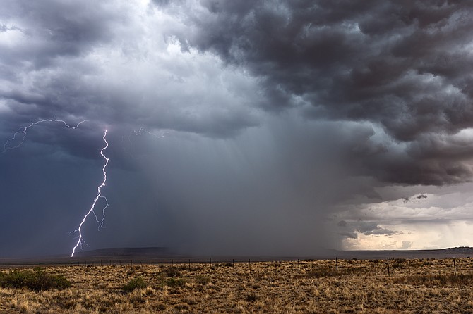
The National Weather Service in Reno called for a chance of thunderstorms to develop into the Sierra and western Nevada by Wednesday and Thursday afternoons coming from the Oregon border. A slow cooling trend was slated to begin Monday with temperatures to return to normal for this time of the year beginning Tuesday through Thursday for the West Coast between the 70s to 80s for the Sierra valleys. The NWS reports isolated cells are north of Portola and Gerlach but could change. Lightning that occurs could increase risk of new fire, and thunderstorm potential could remain Wednesday or Thursday.
Another heat wave in Northern Nevada is expected next week but at what rate is unknown for now. Temperatures in the triple digits are expected to return to the lower valleys during the weekend.

Comments
Use the comment form below to begin a discussion about this content.
Sign in to comment