Seeing the view of Carson City from the top of C-Hill
Kyler Klix/Nevada Appeal
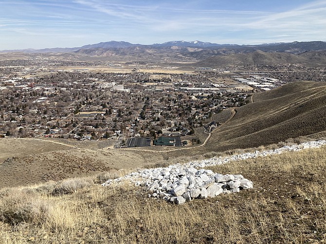
Carson City is seen from the middle of the C on C-Hill. The white rocks can be seen in the foreground. The trail seen goes from the South Ormsby parking area to the South Curry Street parking area.
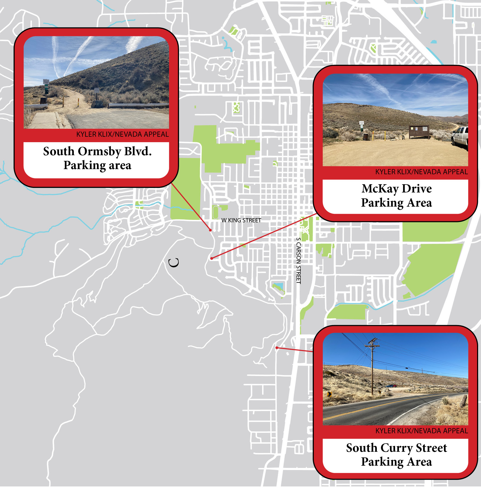
C-Hill is a prominent Carson City landmark that overlooks the city. The hill sits at about 5,775 feet and it is a popular destination for mountain biking and hiking. There are two approaches to reach the top and both are challenging hikes with quick elevation gain. This trek won’t take you deep into nature, but it does offer a beautiful 360-degree view of Carson City from the top. There are no trees or shade along this hike, so protect yourself from the sun and bring plenty of water for your journey. There are three places to park. You can choose an out-and-back hike from each location or you can connect the trails and do a loop (about 4 miles). There’s also a newer path without much elevation gain, which goes from the South Ormsby parking area to the South Curry Street parking area. This stretch of trail is about 1.6 miles. SOUTHERN APPROACH The longer, gradual way to the summit will take about 2.2 miles one-way. There is a parking lot on South Curry Street (about where the Nevada State Railroad Museum is located). From here, there is a clear-cut path that goes left and right and there is an off-road vehicle trail that goes straight up. Avoid taking the off-road vehicle trail. The clear-cut path will be much easier on your feet and the gradual elevation gain makes it easier to handle. From the parking lot, head left at the first intersection. Continue on this and it gradually turns toward the right, going up the first hill. There will be an intersection here where it meets up with the old road and continues following that path for about 2/10 of a mile, where you’ll veer left to a switchback that gradually climbs the second hill. This path once again meets up with the off-road trail, but shortly after, you’ll see a path toward the right (there’s what appears to be cement wall here). This path leads directly toward the C and the flag. If you continue walking below the flag, it will join with the trail that comes up from the north side. From here, you can continue left to the top of the hill (about a quarter mile), where there is a panoramic view. You can follow the road to get back to where you came from, or backtrack the trail you just took. You can also turn right after the flag to loop back. It is about the same distance (2 miles) but much steeper coming down. NORTHERN APPROACH Hiking C-Hill from the north end is a short hike at 0.8 miles one-way, but it is strenuous, as it gets vertical very quickly. From here, it takes about 40 minutes to reach the top. It’s closest to park at McKay Drive but the parking on South Ormsby Boulevard is almost the same distance. There is only one brief break where the trail isn’t climbing up the side of the hill but after this, it’s like climbing a StairMaster to the top. Because of the steep incline, you’re hiking on larger rocks most of the time instead of a smooth dirt path. It’s hard to keep momentum going because hiking the steep incline takes your breath away so much. ‘CHALLENGING’ HILL While this trail doesn’t take you far from civilization, it’s a great place to test what kind of shape you’re in and it’s one of the easiest places to get access. It’s worth going up at least once. After hiking this trail, you might think the C stands for challenging. Always remember to respect nature and other hikers. Leave no trace and take everything you brought in back with you. Kyler Klix is a designer for Nevada News Group. He also writes about the outdoors and entertainment. Email him at kklix@nevadanewsgroup.com.
Comments
Use the comment form below to begin a discussion about this content.

Comments
Use the comment form below to begin a discussion about this content.
Sign in to comment