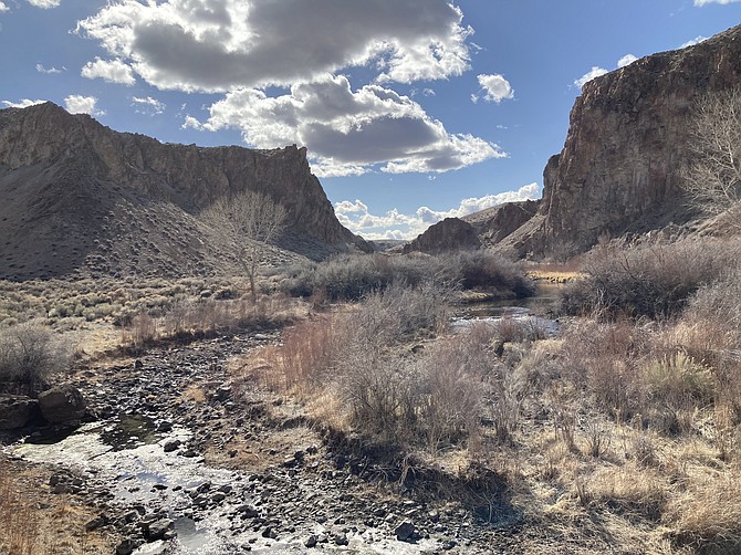
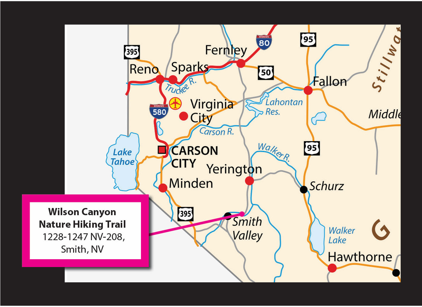
There’s a hike in a canyon between Yerington and Smith that shows the diversity and beauty of the desert. The Wilson Canyon Nature Hiking Trail on Route 208 has much to offer. It’s about an hour and 15 minutes from Carson City, making this a good half-day trip, or you can plan some other stops along the way for a full-day trip. This hike will feed your interest with very cool geological structures and many plants as part of a riparian zone along the river. There are scenic views every way you look along the trail. Rocks of many colors including red, green and purple are scattered about along the way. Inside the canyon it’s silent, with the walls blocking out the echoes from the nearby highway. When you climb to the top, you’ll have a view of Wellington Hills, the Carson Range, Mt. Seigel, the Pine Nut Mountains and the Flowery Range. THE BASICS The Wilson Canyon Nature Hiking Trail climbs into a canyon with steep walls that feeds into the nearby Walker River. It’s a 3.5-mile loop rated as moderate with an elevation gain of 803 feet. The well-marked trail is easy to walk on. There are some scrambling and higher steps to climb inside the canyon. Interpretive signs along the way identify plants and give tidbits of information on geology and history of the area. AMENITIES There’s almost no shade on this hike, so it can get hot. Always bring water and protection from the sun. Be careful hiking here in warmer months from the heat and rattlesnakes. There’s a large parking area and a small picnic spot with two tables and a shaded cover with one trashcan. There are no restrooms, but there are some about a half-mile west on US-208 at a free overnight campsite. GEOLOGY This is a great place to see different geological formations. There are even some terms you might hear for the first time. The trail passes by several hoodoos (a tall spire of rock that protrudes from the bottom of an arid drainage basin). There are petrified tree stumps easily observed and many petrified wood chips scattered about. You’ll find slickensides (a smoothly polished surface created by frictional movement between rocks along two sides of a fault) in several locations inside the canyon. There are signs along the hike pointing out where to find these formations. *Please do not take any petrified wood, leave it all for everyone to see and enjoy. PLANTS AND WILDFLOWERS There are more than 30 signs identifying plants growing in the area along the hike — many of these flowers yet to bloom, being March still. This place is popular for its wildflowers, so it’s possible the best times to visit here is in April or May. If you only know a few plants, you can learn many more first-hand without going off the trail. Always remember to respect nature and other hikers. Leave no trace and take everything you brought in back with you. Kyler Klix is a designer for Nevada News Group. He also writes about the outdoors and entertainment. Email him at kklix@nevadanewsgroup.com.
Comments
Use the comment form below to begin a discussion about this content.

Comments
Use the comment form below to begin a discussion about this content.
Sign in to comment