The National Weather Service has issued a Red Flag Warning for the Sierra Front starting Monday at 11 a.m. and continuing through Tuesday 5 a.m. for conditions that can help fire spread.
The statement at weather.gov said the most critical period will be three to seven hours Monday afternoon, though gusty winds are expected to last more than 18 hours.
“The combination of gusty winds and low humidity can cause fire to rapidly grow in size and intensity before first responders can contain them,” the statement said.
Winds are forecast southwest to west 15 to 25 mph with gusts up to 40 mph. Wind prone areas could see gusts up to 50 mph Monday night.
Humidity is expected to remain below 20 percent in the region and as low as 10 percent in some areas.
“Avoid outdoor activities that can cause a spark near dry vegetation, such as yard work, target shooting, or campfires.”
Additionally, the NWS said there is a slight chance of rain and snow Monday night and freezing temperatures Wednesday morning.
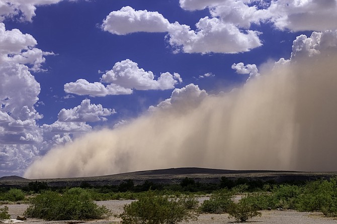
“Strong and gusty southwest winds are expected Monday and Monday night turning northerly and becoming more breezy Tuesday as a cold front moves through. Plan on impacts to air/road travel, choppy lake conditions, areas of blowing dust, and increased fire danger,” the NWS said in a statement.
Sub-freezing temperatures are likely for rural and suburban lower valleys Wednesday morning. Lows could dip into the teens for colder Sierra valleys.
Best chances for rain will be Monday night in the northern Sierra, northeast California, and far northern Washoe County, but amounts will be meager.
Lighter showers are possible as far south as Highway 50 in the Sierra and I-80 in western Nevada. A mix of snow is possible down to around 6,500 feet elevation.

Comments
Use the comment form below to begin a discussion about this content.
Sign in to comment