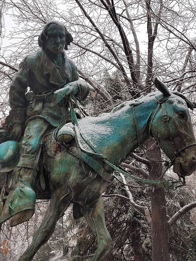
Snow starts to stick on the Kit Carson monument on the Legislative Grounds about 11 a.m. Saturday.
Friday’s rain has turned into New Year’s Eve snow which is supposed to continue until early New Year’s Day.
The National Weather Service says snow accumulations of 4 to 8 inches are expected with 12 to 18 inches above 5,000 feet.
“We could see heavy snowfall here across western Nevada, from northern Washoe County, into the Greater Reno-Carson-Minden Area, and the Basin and Range,” Meteorologist Dawn Johnston said, The Record-Courier reported. “Snowfall amounts could vary greatly depending on where the heavier snowbands set up. Valleys may see 3-8-plus inches of snow accumulation with patchy ice this evening. Higher snowfall amounts look to occur above 5000 feet, with 8-plus inches likely.”
The winter storm warning is in effect until 4 a.m. Sunday.
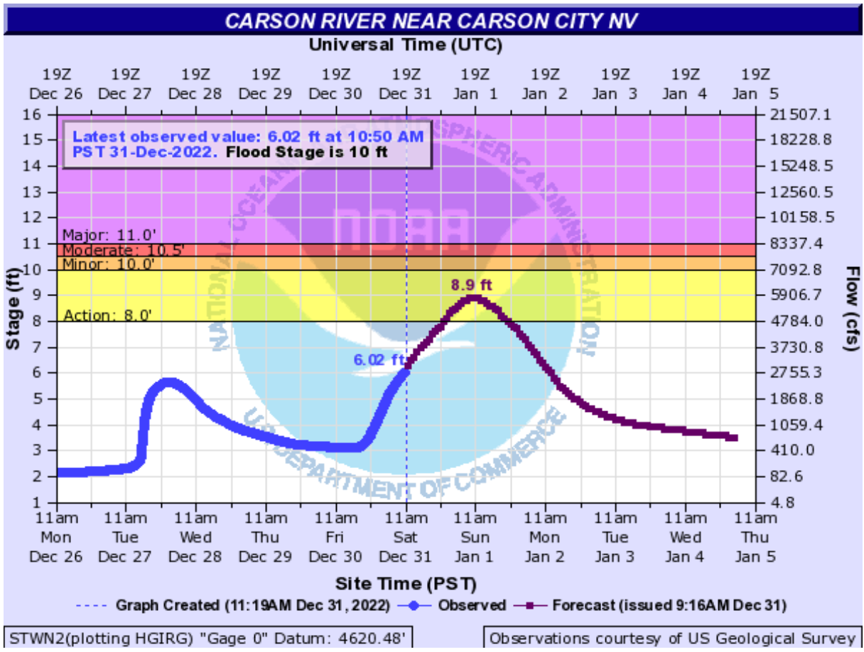 The Carson River near Snyder Avenue south of Prison Hill is predicted to crest just below flood stage.
“Avoid travel if possible, you could be stuck in your vehicle for many hours. If you must travel, prepare for long delays and carry an emergency kit with extra food, water and clothing. If you stay home, have a backup plan in case of power outages.”
The latest road conditions can be obtained by calling 5 1 1 or by visiting NVRoads.com.
As of 11:30 a.m. chain controls were on I-580; Highway 50 to Lake Tahoe and toward Dayton; and on Highway 395 into Douglas County.
In Carson City, localized flooding is occurring in low-lying areas. The southbound lanes of North Carson Street have water over the roadway and certain side streets shouldn’t be accessible due to driving through flooded roadways.
A stronger storm Jan. 4-5 is possible with gusty winds, significant snowfall, and impacts to travel.
 The Carson River at Deer Run is likely to reach the "action area" of 12 feet. It was at 10.3 feet as of 11 a.m. Saturday.
Tips for residents:
• Never drive or walk through flooded streets; Turn Around, Don’t Drown! Do not go through flood waters.
• Stay vigilant and aware of your surroundings
• Sign up for Douglas County’s REVERSE 911 service at: https://douglascounty.onthealert.com/Terms/Index/?ReturnUrl=%2f
• Make sure government alerts are turned on in your phone settings
• Stock up on gas and groceries in case of a power outage or road closures in the area
• Check on your neighbors to make sure they are okay or may need help in the event of flooding
• Know what to do before, during, and after a flood.
• Consider the safety of your pets and livestock. If possible move livestock to higher ground.
• Flood insurance takes 30 days to take effect, so purchase now to protect your family
• Listen to local officials by radio, TV or social media, follow the Douglas County Facebook, Twitter or website for updates
• Evacuate when advised by authorities or if you are in a flood or flash flood-prone area.
• If you are on high ground above flooded areas, being prepared to stay where you are may be the best protection.
• Remove yard items that might have the potential for damage.
• Clear away any existing debris which may clog drainage.

Comments
Use the comment form below to begin a discussion about this content.
Sign in to comment