As rain pummeled the Carson City region Saturday, Nevada Gov. Joe Lombardo amended an emergency declaration to include Carson City and other counties affected by the weather. The good news for the capital city, according to department heads, is the city didn’t experience significant damage over the weekend, and the declaration may help mitigate weather impacts this week.
“Carson City did have some localized flooding but no significant damage,” Carson City Fire Chief Sean Slamon said Monday. “This is directly attributed to improvements made in our drainage system. Our emergency call volume remained steady through the storm and throughout the weekend but again no major storm-related problems.”
However, Slamon was concerned about additional storms this week.
“We are concerned with the additional warm storm forecasts as the ground is saturated,” he said. “The governor declaring a state of emergency that includes Carson City will be very beneficial if we do experience flooding and storm-related damages.”
The National Weather Service forecast more rain and snow through Wednesday along with continued flood concerns. A flood advisory was in effect through Tuesday night.
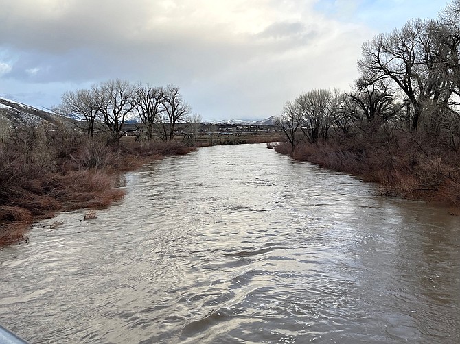
“Areas of primary concern are small creeks and streams and areas with poor or obstructed drainage, especially if impacted by flooding recently,” said the NWS. “Renewed river flooding is also a concern especially in the Carson Valley, along the Carson mainstem, and along the East Fork mainstem of the Walker River.”
Snow levels could drop to near valley floors Wednesday morning, according to the NWS. As of Monday, the National Oceanic and Atmospheric Administration’s hydrologic models showed the Carson River near Carson City cresting on Thursday morning at 9.7 feet, well above monitor stage of 8 feet but just below the flood stage of 10 feet.
NOAA also showed 1.37 inches of accumulated precipitation in Carson City for the month of March, as of Monday. The normal is .62 inches for the same time period. Since the water year began Oct. 1, Carson has seen 9.33 inches of precipitation versus the normal of 6.77 inches for the time period.
The NWS did forecast a break in weather Thursday but with more scattered storms expected this weekend and a more significant system possible next week.
According to Carson City Public Works’ Stormwater Management Program, since Carson City was founded in 1851, approximately 29 major flood events have occurred. Recent events include a flood in 2005 that caused more than $2 million in damage and the mass flooding of 1997 that caused an estimated $5.3 million in damage.
Public Works Director Darren Schulz said from the perspective of the department, Carson City was fortunate the recent storm didn’t do more damage.
“It’s a testament to our Board of Supervisors for moving forward with a stormwater program that really helps mitigate major issues when the big storms do come,” he said. “Having said that, we did have and are having some issues around the city with washouts and debris flows onto the streets. We are currently working on cleaning those up. We are also preparing for the next storm, by clearing all the drains and stormwater pipes/culverts so there can be unimpeded flow.”
Schulz warned of more rapid runoff this week due to “primed foothill elevation snowpack and saturated ground conditions.”
“In terms of the state of emergency, it’s still too early to tell what the overall damage is to Carson City, and that assessment will be conducted after we get a few days of clear weather,” he said.
Public Works has set up a webpage about sandbags and flood preparedness: https://www.carson.org/government/departments-g-z/public-works.

Comments
Use the comment form below to begin a discussion about this content.
Sign in to comment