October 24, 2016
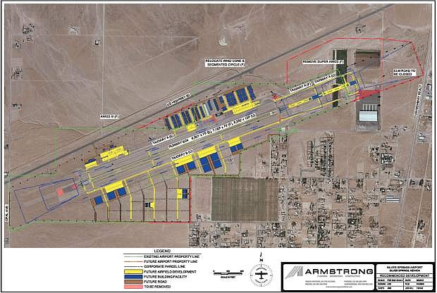
The Silver Springs Airport is seen in this aerial photograph overlaid with future development proposed in an updated master plan. Airfield development is seen in yellow and buildings and facilities, in blue.
The Silver Springs Airport is completing an updated master plan and master lease agreement with Lyon County. The timing couldn’t be much better. By the end of 2017, the USA Parkway will link Interstate 80 and U.S. Highway 50. The new thoroughfare through the midst of the Tahoe-Reno Industrial Center (TRI) will connect to U.S. Highway 50 just one mile west of the airport.

Comments
Use the comment form below to begin a discussion about this content.
Sign in to comment