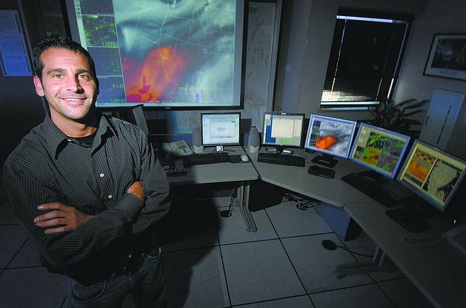
Kevin Clifford/Nevada Appeal Rhett Milne, meteorologist for the National Weather Service in Reno says the mountains make predicting weather in western Nevada a challenge.
Rhett Milne has been a meteorologist with the National Weather Service for eight years, the past six in Reno. He received a bachelor's degree from the University of Oregon and a master's degree from the University of Wisconsin.
His primary duties are issuing weather forecasts and warnings for western Nevada and eastern California. He also works with other federal, state, county and city governments, ensuring they are aware of the forecasts and warnings the weather service issues so they can be prepared for natural disasters such as floods, wildfires and crippling winter storms.
What purpose does the weather service have in Northern Nevada?
To save lives and property and to help enhance the economy. We accomplish this by issuing warnings for flash floods, tornadoes (yes we do get them here, although they are rare), river floods, winter storms, windstorms, etc. We also issue Fire Weather Forecasts and Red Flag Warnings to help keep firefighters safe and to help other agencies know when to move resources to help battle wildfires across the state. Meteorologists at the NWS keep an eye on all these hazards 24 hours a day, 365 days a year. In addition, we are one of the primary initiators of the Emergency Alert System, whether it's for weather warnings or nonweather warnings such as chemical spills or mandatory evacuation.
How many meteorologists work at the NWS (in Northern Nevada)?
There are 14 meteorologists and one hydrologist. This does not include additional staffing who maintain electronics and weather equipment, computer systems, or collect weather and climate data.
What causes clouds to look like "flying saucers" on the east side of the Sierra Nevada?
These types of clouds are called lenticular clouds and occur when there are very strong winds moving across the Sierra Nevada. The range forces the winds to flow up and over the mountains which provide additional lift within a deep layer of the atmosphere. This additional lift causes moisture to condense into the lenticular clouds we see. Lenticular clouds are unique in the sense that they result from very strong winds which give them the very smooth appearance. A good thing to keep in mind is that if you are seeing lenticular clouds, it's very likely the winds are going to be howling.
How do thunderstorm clouds appear so quickly on a clear day?
The sun is the main driver for the development of thunderstorms as long as we have enough moisture (water vapor) in the air. It takes the sun most of the day to build enough heat to get a thunderstorm to develop. The heat builds in the lowest levels of the atmosphere and isn't allowed to rise because we typically have an inversion around 15,000 feet. We call this inversion a "cap" as it prevents the air from rising above this level. However once there is enough daytime heating from the sun the air becomes so warm that it can bust through this cap encountering an environment where this air is free to rise to heights well above 35,000 feet. As this air rises, moisture rapidly condenses into clouds, rain and hail, thereby producing a rapidly developing thunderstorm.
What makes forecasting thunderstorms in the Carson City, Minden, Gardnerville and Reno areas so difficult?
Moisture is the most important ingredient for thunderstorm development. If we have moisture in place, thunderstorms will usually occur. But the greatest challenge predicting storms along the Highway 395 corridor in the lee of the Sierra Nevada results from the afternoon westerly winds. We get thunderstorms that begin to build over the mountains and along the Sierra Front, but the afternoon westerly winds push the developing thunderstorms east before they can mature enough to produce a good rain or lightning show.
Why is it so windy during summer afternoons in western Nevada?
First let's explain what causes wind. Wind is the result of differences between high and low pressure. The best way to describe what causes wind is to think of a can of vacuum sealed coffee. When you open the can of coffee you hear a whoooosh sound. That is because there is very low pressure in the unopened can of coffee and the air rushes in to fill the void. You essentially created wind by opening the can. Now let's relate that to Nevada. Typically in the summer, the lower elevations of central Nevada are much hotter. All this very hot air rises and air is required to rush in to replace it. It's essentially like a very large vacuum sealed can being opened every afternoon in central Nevada and the strong westerly winds we experience are created from the air rushing in to fill the void left by the rising hot air.
Are you aware of any weather anomalies in Northern Nevada?
There are many weather anomalies in Northern Nevada. Every mountain range, valley, lake and river has its own micro-climate. This makes forecasting the weather in our area very difficult. For example, think of a winter storm. The mountain tops will get several feet of snow, high valleys will receive a bit less, the lee side valleys, like Carson City may receive a dusting or nothing and the foothills receive amounts somewhere in between. It's a challenge to the meteorologist explaining in a simple manner how much snow you might receive because elevation and location is everything. Lake effect snow coming off of Lake Tahoe is another weather anomaly.
What makes predicting the weather easy/difficult?
Weather is never easy to predict unless there is a strong ridge of high pressure over the region resulting in fair skies. Location and the topography make predicting a challenge. Let's first focus on our location. Most of our weather comes from the west off the Pacific Ocean. The Pacific is a huge data void area where we have very little weather information. Besides a few ocean buoys, airplanes and ships crossing the Pacific, the number of observations fail in comparison to what we have over land. This makes sampling weather systems upstream before they get to us very difficult. This forces the meteorologist to rely heavily on satellite imagery and computer models to determine what is going on with storms before they reach us. Compare that with the central and eastern U.S. where they have a vast network of land sensors, weather balloons and aircraft upstream which they can monitor before storms reach them.
It's much easier to forecast snowstorms in the Sierra Nevada than in western Nevada. The greatest challenge is determining how much precipitation will "spillover" and affect the valleys. Some storms drop feet of snow in the Sierra and we only get a few flurries, while other times we can get hit just as hard. It's a very subtle difference in the mechanism that allows precipitation to spillover versus us being "shadowed" out by the mountains.
Is Global Warming real and are we seeing it's effects in western Nevada?
This is obviously a controversial subject that has received much attention recently. The short answer is yes, it's occurring. But it's a lot more complicated than that. When analyzing the average annual temperature for Reno, six of the warmest seven years on record have occurred since 2000. This year is also on pace to be one of the warmest ever. However, Reno has experienced incredible growth and some of that warmth can be attributed to the heat island effect which results from black asphalt and other manmade construction. Therefore, it's important to also examine temperature statistics for smaller towns such as Lovelock, Minden and Tonopah that have experienced less growth. For these locations, some of the warmest years on record have also occurred since the year 2000, but their magnitude of warming is less than larger cities like Reno. To further support the reality of Global Warming, it would have to be one heck of a coincidence that this record and extreme warmth is occurring within the normal cycles of climate and weather.

Comments
Use the comment form below to begin a discussion about this content.
Sign in to comment