Submitted PhotoThis 2.8 mile trail offers close-up views of the ditches along Linear Park and the creek that flows into the Carson River, with willows, cattails, cottonwoods and a lot of bird life.
The multiuse path is open from Roop Street to Moffat Open Space. The western section, Linear Park, is now joined to the eastern section from Moffat Open Space near Mexican Ditch.
The middle section was part of the Phase 2A of the freeway that just opened. The path crosses under the freeway alongside Eagle Creek.
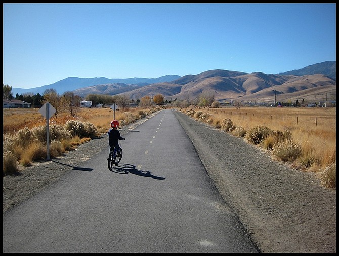
This 2.8 mile trail offers close-up views of the ditches along Linear Park and the creek - often called Eagle Creek, but it has no official name. The creek eventually flows into the Carson River, with willows, cattails, cottonwoods and a lot of bird life.
This is a less developed part of the valley, and it feels like you are a long ways away. Once the cottonwoods come back along the "Eagle Creek" wetland, this should be a really beautiful ride.
The Linear Park section has several interpretive signs. The new section, just opened a few days ago, is already getting quite a bit of bicycling and walking use.
The path provides access to Fremont Elementary School by students living in the Eagle Valley neighborhood, and to Eagle Valley Middle School by students living in the Fremont and Seeliger neighborhoods.
NDOT, Carson City Public Works, Muscle Powered, and the Safe Routes to School Carson City program are talking about having a grand opening for the path. It may happen this fall, before the snow flies, or it may happen in the spring.
Here are some places to be careful along the way:
1. If you are entering the path from Roop Street southbound or exiting the path to Roop Street southbound, you'll be turning across traffic on a limited sight distance curve.
2. The crossing of Saliman Road is marked by pedestrian and bicycle route signs. Some people will stop for you, but others won't, so yield and don't cross until traffic is clear or stopped.
3. The path crosses two gated cattle guards, which serve to allow the cows to travel freely between their north and south pasture, but to keep the cows off the rest of the path.
The east gate will latch, but the west gate latch is currently broken and the gate is closed with a wire instead. Please keep the cows and the people happy by closing the gate behind you.
4. At the tight curve diving underneath the freeway, watch for both other bicycles and for pedestrians, since sight distance is very short.
5. As the path approaches Butti Way, it diverges. The right fork is probably intended to be the through route, but it leads to the crosswalk over Butti at Fifth Street.
As a committed vehicular cyclist, I cringe riding across crosswalks, so I instead use the left fork and turn right onto Butti and then left again onto the path. Coming the other way, I turn right onto Butti and then left onto the path.
6. If you leave the path at the roundabout, use caution. Though drivers are gradually becoming more adept at using the roundabout by taking turns and slowing down, it is still a place to be careful. Take the lane and do not allow yourself to be squeezed to the right.
7. The crossing of Fairview Road at the user-activated flashing light is becoming safer, however, about 20 percent of the drivers are still ignoring this signal and blasting on through.
Don't cross until cars from both directions have stopped, and please acknowledge them for doing the right thing.
New bike lane on Winnie Lane
Along with the recent slurry seal, or repaving, projects going on in the northwest part of Carson City, which is part of the city's effort to preserve and extend its road investment, Winnie Lane between Carson Street and Mountain Street was striped with bike lanes.
The stripes are bright, and the lane is marked with the bike symbol. The lane was even done correctly as it approaches Carson Street, with skip lines (broken or dashed) to indicate a merge of traffic to the right turn lane.
This is how it is supposed to be done! Winnie Lane to the west of Mountain Street is already designated a Principal Route (green) on the Carson City Bicycle Route Map.
Winnie Lane to the east is wide enough for safe bicycling, but then you get to Roop Street, which is not yet, but may be in the future as a project to the north will add a path and to the south there may be re-striping or shared lanes to make it safe.
Thank you Carson City Public Works for the new bicycle lane!
• Dan Allison is coordinator for the Safe Routes to School Program and writes regularly on the musclepowered.org Web site.

Comments
Use the comment form below to begin a discussion about this content.
Sign in to comment