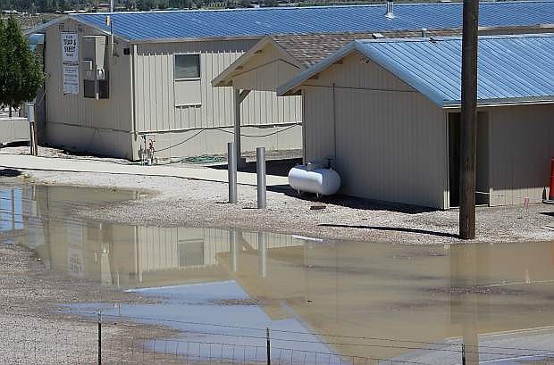
Saturday's rain caused little flooding in Churchill County although pools of water formed at the trap club and also at the adjacent Rattlesnake Raceway track.
An unsettled weather patter caused by a low level pattern shifting inland from the Pacific Coast will bring lower temperatures and more thunderstorms to Northern Nevada this week.
The forecast for Tuesday night is a 50 percent chance of rain.
Churchill County received an early taste of the unique weather pattern on the Fourth of July when heavy rain began to pelt the valley and caused family day at the fairgrounds to close early. Racing at Rattlesnake Raceway was postponed because of a muddy track. A total of .24 inches of rain fell in a six-hour period according to the National Weather Service.
Both the Fallon Police Department and Churchill County Sheriff’s Office did not receive reports of flooding.
According to the NWS in Reno, the low pressure is also bringing more cloudiness to the region, and Thursday could be the coolest day of the week.
Meteorologist Wendell Hohmann said central Nevada will see temperatures drop from last week’s triple digits to the low 80s in the daytime and 50s at night.
“The temperatures will be pretty nice for those tired of the heat,” he said.
While the eastern Sierra Front has received the most severe weather over the last 72 hours, Hohmann said central Nevada to include Churchill, Lyon and Mineral counties, have the opportunity to receive strong storms with winds gusting up to 60 miles per hour.
“Heavy rain could also produce flash flooding,” he added.
For commuters to either Reno or Carson City, Hohmann said motorists must be familiar with the conditions. He said U.S. Highway 50 to Carson City has several areas prone to flooding: Silver Springs and east of Dayton. He said the canyons between Fernley and Sparks on Interstate 80 are prone for receiving heavy rain and for producing poor visibility on the road.
“Those conditions should warrant people to slow down,” Hohmann said.
On Sunday night, the Silver Springs area encountered flooding. Lyon County Manager Jeff Page said the Ramsey-Weeks Cutoff was significantly impacted, but the road reopened Monday morning. He added a number of surface streets were impacted, and public works crews assessed damage and established priorities for cleanup.
EXTENDED WEATHER FORECAST
Tonight
Scattered showers and thunderstorms before 11pm. Mostly cloudy, with a low around 59. West wind 5 to 10 mph becoming southeast after midnight. Chance of precipitation is 50%.
Wednesday
Scattered showers and thunderstorms after 11am. Partly sunny, with a high near 86. North wind around 5 mph. Chance of precipitation is 40%.
Wednesday Night
Scattered showers and thunderstorms before 11pm, then isolated showers. Mostly cloudy, with a low around 58. Northwest wind 5 to 10 mph. Chance of precipitation is 30%.
Thursday
Isolated showers, then scattered showers and thunderstorms after 11am. Partly sunny, with a high near 81. West wind around 5 mph becoming calm. Chance of precipitation is 40%.
Thursday Night
Scattered showers and thunderstorms before 11pm, then a slight chance of showers. Mostly cloudy, with a low around 55. Chance of precipitation is 40%.
Friday
A chance of showers, with thunderstorms also possible after 11am. Partly sunny, with a high near 84. Chance of precipitation is 30%.
Friday Night
A chance of showers and thunderstorms before 11pm. Partly cloudy, with a low around 54.
Saturday
A slight chance of showers and thunderstorms after 11am. Partly sunny, with a high near 86.
Saturday Night
A slight chance of showers and thunderstorms before 11pm. Partly cloudy, with a low around 55.
Sunday
Sunny, with a high near 89.
Sunday Night
Mostly clear, with a low around 55.
Monday
Sunny, with a high near 91.

Comments
Use the comment form below to begin a discussion about this content.
Sign in to comment