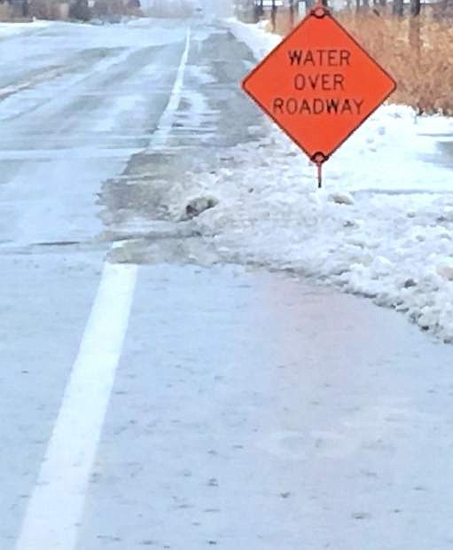
Signs indicate water on the roadway on Cottonwood Lane and in the Fernley Farm District.
While western Nevada and the Sierra Nevada mountain range weathered several days of heavy rain and flooding, the Lahontan Valley dodged a bullet with isolated reports of flooding in the Silver Springs-Fernley area and Churchill County.
On Tuesday afternoon, though, US 95 South at mile marker 65 in Mineral County was closed in both directions due to a mudslide.
A pretty substantial mudslide fell in the Walker Lake area about 10 miles north of Hawthorne. Nevada Department of Transportation maintenance crews began removing the mud and rock debris to make the road safe. NDOT reopened the highway late afternoon.
The Truckee Carson Irrigation District focused on the flow of water into Lahontan Reservoir from both the Carson River and the Truckee, which diverts water at Derby Dam to the Truckee Canal.
Rusty Jardine, TCID’s district manager, said TCID reduced the flow in the Truckee Canal, which is limited to 350 cubic feet per second, to compensate for side flow.
“We moved the water down from the dam which was doing its thing,” Jardine said.
By maintaining a constant flow of water, Jardine said TCID didn’t experience any major problems. Additionally, TCID personnel monitored the flow and checked periodically on the canal.
“There was a touch of flooding in Fernley, but it was not caused by the canal,” Jardine added.
Since the major storm developed Friday and delivered inches of rain to Northern Nevada that melted snow in the valleys and a good portion of snowpack in the mountains, Lahontan Reservoir may be the only bright spot.
Since Friday, the United States Geological Survey in Carson City verified the reservoir has added 11,227 acre-feet of water as of Tuesday, which translates into more than 3.6 billion gallons of additional water.
Steve Endacott, the city of Fallon’s emergency director, said the big success story goes to TCID.
“TCID did an effective job in managing Derby Dam and the diversion canal and then monitoring the water flows to the reservoir,” Endacott said.
Furthermore, he said the accurate weather forecasting also helped officials from Northern Nevada prepare.
“The forecasters were pretty spot on,” Endacott said of their weather predictions. “They were conservative but they were close, and their timing was on … good forecasting reaction time.”
As for Fallon, residents encountered some areas of minor flooding including the west section of Ideal Mobile Home Park, which floods during a heavy rain, and on several roadways.
Churchill County Sheriff Ben Trotter said he did not receive any reports of minor or major damage, but he planned to drive out to the reservoir and dam to check out the situation.
Lyon County Manager Jeff Page reported several problems in communities along U.S. Highway 50 and Fernley. In a situation status report, he said one house in Stagecoach reported water in its basement, and water forced the closure of the following intersections on Sunday: Kiowa and Seminole. Pueblo and Esmeralda. In Silver Springs, county crews closed Ruby and Opal avenues.
Water running over the roadway shut down U.S. Highway 50 Alternate Sunday night between Fernley and Silver Springs. Later, the northbound lane of traffic was open to allow vehicles passage. Page said several residents west of Highway 50A/95A on Sage Street were threatened, and the county closed Summer Wind Road at Ponderosa Park.
Additionally, Page said Nevada Division of Forestry crews assisted with sandbagging. With the water subsiding, Page said crews have been clearing drainages and continuing with their sandbag operations. Roads will reopen when the county deems them safe.
In the meantime, the Lyon County Sheriff’s Office will monitor the local rivers, drainage and bridges. Page said no problems were reported with the bridge spanning the Carson River at Fort Churchill.
Before the storm, maintenance crews from the Nevada Department of Transportation in Lyon and Churchill counties cleaned state road drainages in preparation for the storm, said spokeswoman Meg Ragonese. She said there were two different locations on U.S. 50 east where water did flood the roadway — one in Silver Springs and the other in the Stagecoach area.
Water is still running alongside roadway drainages of U.S. 95A, and once the water subsides, Ragonese said NDOT may need to conduct minor road maintenance to repair the roadway shoulders.
Reno was the hardest hit community with the flooding of roads and businesses. Officials believe the washouts ended up not as devastating as once they had feared.
The Truckee River peaked at 19.5 feet on Monday, more than four feet above flood stage, but less than the projection of 20.5 feet. About 200 people, who spent the night at emergency shelters, began retuning home on Monday.
The Associated Press reported the hardest-hit area is an industrial and warehouse district in Sparks next to Reno.
The Nevada National Guard deployed a team of five high water vehicles Monday morning to assist with potential evacuations and flood support Lockwood, east of Sparks along the Truckee River. Lt. Col. Mickey Kirschenbaum, public affairs officer, said the Storey County emergency manager asked for assistance.
Additionally, the National Guard deployed two high water vehicles in support of Washoe County to move two Preliminary Damage Assessment Teams in Sparks. Kirschenbaum said the Guard has additional personnel and resources available to assist as needed to include high water vehicles located in Stead, Reno and Carson City as well as UH60 Blackhawk and a CH47 Chinook helicopters located at Stead.
Looking at the week, the area should expect sunshine by Friday. Wednesday and Thursday are calling for a chance of rain and/or snow showers with highs in high 40s on Wednesday and near 38 on Thursday. The morning low Wednesday will drop to 27 and even more for Thursday at 17. Chance of precipitation both days ranges between 30-60 percent.
Friday will be mostly sunny with a high hovering near 40.

Comments
Use the comment form below to begin a discussion about this content.
Sign in to comment