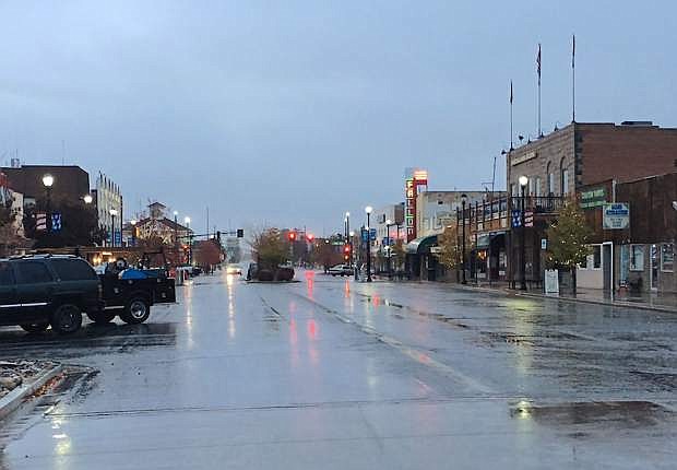
Fallon
Today
A slight chance of rain and snow showers before 4pm, then a slight chance of rain showers. Mostly cloudy, with a high near 42. Southwest wind 5 to 10 mph. Chance of precipitation is 20%.
Tonight
A 20 percent chance of snow showers after 10pm. Mostly cloudy, with a low around 29. South wind around 5 mph.
Friday
A chance of snow before 10am, then a chance of rain and snow. Mostly cloudy, with a high near 41. Southeast wind around 15 mph, with gusts as high as 30 mph. Chance of precipitation is 50%. New snow accumulation of less than a half inch possible.
Reno/Carson City
Today
Snow likely before 10am, then a slight chance of snow showers after 10am. Mostly cloudy, with a high near 40. Southwest wind around 10 mph, with gusts as high as 20 mph. Chance of precipitation is 60%. Total daytime snow accumulation of less than a half inch possible.
Tonight
A slight chance of snow showers before 4am, then snow after 4am. Low around 31. South wind 5 to 10 mph. Chance of precipitation is 80%. New snow accumulation of less than one inch possible.
Friday
Snow before 10am, then rain and snow likely. High near 39. Southeast wind around 10 mph, with gusts as high as 20 mph. Chance of precipitation is 80%. New snow accumulation of 1 to 2 inches possible.
Winter Weather Advisory
URGENT - WINTER WEATHER MESSAGE
NATIONAL WEATHER SERVICE RENO NV
GREATER RENO-CARSON CITY-MINDEN AREA-
INCLUDING THE CITIES OF SPARKS, GARDNERVILLE, AND VIRGINIA CITY
409 AM PST THU JAN 19 2017
...WINTER WEATHER ADVISORY IN EFFECT FROM 6 AM TO 10 PM PST
FRIDAY...
THE NATIONAL WEATHER SERVICE IN RENO HAS ISSUED A WINTER WEATHER
ADVISORY FOR SNOW, WHICH IS IN EFFECT FROM 6 AM TO 10 PM PST
FRIDAY.
* TIMING: SNOW WILL BEGIN EARLY FRIDAY MORNING AND CONTINUE
THROUGH EARLY SATURDAY MORNING.
* SNOW ACCUMULATIONS: 1 TO 3 INCHES BELOW 5000 FEET WITH 2 TO 5
INCHES POSSIBLE IN FOOTHILLS ABOVE 5000 FEET.
* SNOW LEVELS: ALL VALLEY FLOORS RISING TO 4500 FEET FRIDAY
AFTERNOON.
* IMPACTS: EXPECT HAZARDOUS TRAVEL CONDITIONS AND CHAIN OR SNOW
TIRE RESTRICTIONS DUE TO SLICK ROADS.
PRECAUTIONARY/PREPAREDNESS ACTIONS...
EVEN LIGHT SNOWFALL CAUSES MAJOR TRAVEL DELAYS, ESPECIALLY DURING
PERIODS OF HIGH TRAFFIC VOLUME. BE SURE TO ALLOW EXTRA TIME TO
REACH YOUR DESTINATION. LEAVE EXTRA SPACE BETWEEN VEHICLES SINCE
IT TAKES LONGER TO STOP ON SLICK ROADWAYS.

Comments
Use the comment form below to begin a discussion about this content.
Sign in to comment