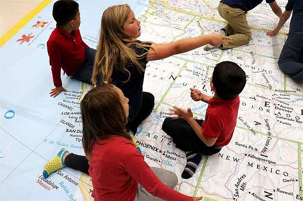
Students at Bordewich Bray Elementary discuss which lands belong to the United States, based off of National Geographic's map.
It would be no surprise if students at Bordewich Bray Elementary School were left with a sense of wanderlust for the weekend, as each grade took a mini expedition on one of the largest maps of the North American continent.
Provided by National Geographic’s Giant Traveling Maps program, students learned about dimensions of the continent, map legends, locations and roads. Since most maps are distorted, National Geographic’s accurately illustrates North America’s oceans, seas, rivers, mountains, countries and capitals.
The vinyl map measured 35 feet by 26 feet, allowing students to walk on top of it.
“It’s the coolest map I’ve ever seen,” said Thomas Lance of second grade. “I learned that Alaska is a part of the United States, and Greenland is mostly ice.”
Rachel Croft, STEM teacher at the school, made it possible as she’s part of the Carson City School District’s STEM movement to bring more technology into education.
Last year, Croft brought Google Expeditions and virtual reality to classrooms.
“I usually try and secure one ‘pie in the sky’ innovative way for students to learn,” she said. “This year, I was able to secure the grant to pay for Nat Geo to send their Giant Traveling Map to our school for a week.”
Croft said the interactive map is during physical education class, as it’s considered an active way of learning. Bordewich even hosted a home-schooled student on Friday to explore the map.
Croft said most students were fascinated by Alaska, as many weren’t sure if it was part of the United States.
As for Hawaii, the state had its own map to match approximate geographical measurements.
But one of the main reasons why the school supports the activity is tracing road lines on maps enhances reading comprehension, Croft said.
“In all P.E. classes, there are cross lateral activities,” she said. “Tracing roads and lines with dominant and non-dominant hands supports that, compared to traditional motor skills they’re accustomed to.”
National Geographic’s Giant Traveling Maps program was introduced in 2006 with a map of Africa and has since expanded to include giant maps of North America, Asia, South America, Europe and the Pacific Ocean.

Comments
Use the comment form below to begin a discussion about this content.
Sign in to comment