


 •••
Northbound I-580 is currently blocked at N. McCarran Boulevard because of weather conditions.
Due to the inclement weather anticipated by the National Weather Service, and in the interest of their safety, our delivery team may experience travel challenges and delays. To stay on top of breaking news, and to get the information you have come to trust from the Nevada Appeal, visit our website, download our app, follow us on social media and view our e-edition online.
•••
"Due to the current weather and forecast for the night, we are cancelling the Early Childhood Expo," said organizer Natalie Wood.
"We want to make sure that all of the vendors and community members in Carson City are safe! Thank you for your support of the event, we hope that you understand."
•••
For those of us who had to work today, the evening commute looks ok at the 4 p.m. hour, but the snow has picked up immensely in the past 30 minutes.
Here's a look at road conditions at 4 p.m., visit http://nvroads.com/ for more.
•••
Northbound I-580 is currently blocked at N. McCarran Boulevard because of weather conditions.
Due to the inclement weather anticipated by the National Weather Service, and in the interest of their safety, our delivery team may experience travel challenges and delays. To stay on top of breaking news, and to get the information you have come to trust from the Nevada Appeal, visit our website, download our app, follow us on social media and view our e-edition online.
•••
"Due to the current weather and forecast for the night, we are cancelling the Early Childhood Expo," said organizer Natalie Wood.
"We want to make sure that all of the vendors and community members in Carson City are safe! Thank you for your support of the event, we hope that you understand."
•••
For those of us who had to work today, the evening commute looks ok at the 4 p.m. hour, but the snow has picked up immensely in the past 30 minutes.
Here's a look at road conditions at 4 p.m., visit http://nvroads.com/ for more.

 •••
Carson City will have to wait until the weekend to catch a break from the winter weather.
In the last 24 hours, the city was hit with two to five inches of snow, and even more in some of the hillier areas of the community, according to the National Weather Service Reno. And meteorologist Zach Tolby said Carson and Reno are in for a second wave of weather Friday night.
By Saturday morning, Carson can expect another couple of inches.
•••
Carson City will have to wait until the weekend to catch a break from the winter weather.
In the last 24 hours, the city was hit with two to five inches of snow, and even more in some of the hillier areas of the community, according to the National Weather Service Reno. And meteorologist Zach Tolby said Carson and Reno are in for a second wave of weather Friday night.
By Saturday morning, Carson can expect another couple of inches.
 The Sierra have been pounded with snow, seeing 2 to four feet by Friday morning and an expected additional 8 to 14 inches Friday night. Tolby said they have received about a foot and a half at lake level by Friday morning.
However, a winter storm like this isn't out of the typical.
"We do get big storms at this time of year," Tolby said. "It is definitely on the strong side, but nothing record breaking."
Once the next band of weather occurs Friday night, the snow will start cleaning up in the valley Saturday and everything should be cleared up by Sunday, Tolby said. Temperatures will warm Sunday and Monday, from the mid-30s to mid-40s.
Then Northern Nevada will see a break in the weather early next week, before another potential storm rolls in at the end of the week.
"We will have a decent break but the weather will stay active," Tolby said.
But, for Friday, Carson residents will get the opportunity to enjoy the snow day, as all schools and state offices closed due to weather.
Despite not having school today, Mr. Carson High will take place tonight. The event is tonight at 6:30 p.m. at the Carson City Community Center. The fundraiser benefits the Carson High Cheer Team
•••
From The Associated PresS: More than 3 feet of new snow (90 centimeters) in the Sierra and winds gusting to nearly 150 mph (240 kph) over the ridge tops temporarily shut down Interstate 80 on Friday and forced the cancellation of schools and state offices from Reno to Lake Tahoe.
More than another foot of snow was possible into Saturday.
A blizzard warning expired Friday but whiteout conditions were still possible around Lake Tahoe, where a winter storm warning remained in effect until 10 a.m. Saturday, the National Weather Service said.
I-80 reopened Friday morning but chains or snow tires were required from west of the California-Nevada line across the top of the Sierra, and on all major mountain passes.
“Strong winds will cause whiteout conditions in blowing and drifting snow at times,” the Weather Service in Reno said Friday. “Avoid travel if possible. You could be stuck in your vehicle for many hours.”
Four feet (120 cm) already has fallen at Mammoth Mountain south of Yosemite National Park. A 146 mph (235 kph) gust of wind was recorded Thursday night atop Squaw Valley resort on the north end of Lake Tahoe, with a gust of 137 mph (220 kph) at neighboring Alpine Meadows.
Three feet (90 cm) of snow was measured at the Kirkwood resort south of Lake Tahoe and at the Mount Rose ski resort on the southwest edge of Reno.
Up to 6 inches (15 cm) of snow fell in the Reno area, which remains under a winter weather advisory until 10 a.m. Saturday. An 82 mph (132 kph) gust of wind was recorded Thursday on the west edge of Reno near Verdi.
The biggest storm of the season prompted one area ski resort to postpone a ceremony planned Saturday to celebrate the accomplishments of several Lake Tahoe-area Olympians just back from the Winter Games in South Korea.
Snowboarders Jamie Anderson, who won gold and silver medals, Maddie Bowman and Hannah Teter were among those scheduled to attend the daylong event at Sierra-at-Tahoe south of the lake.
•••
Gov. Brian Sandoval has declared a snow day.
The Sierra have been pounded with snow, seeing 2 to four feet by Friday morning and an expected additional 8 to 14 inches Friday night. Tolby said they have received about a foot and a half at lake level by Friday morning.
However, a winter storm like this isn't out of the typical.
"We do get big storms at this time of year," Tolby said. "It is definitely on the strong side, but nothing record breaking."
Once the next band of weather occurs Friday night, the snow will start cleaning up in the valley Saturday and everything should be cleared up by Sunday, Tolby said. Temperatures will warm Sunday and Monday, from the mid-30s to mid-40s.
Then Northern Nevada will see a break in the weather early next week, before another potential storm rolls in at the end of the week.
"We will have a decent break but the weather will stay active," Tolby said.
But, for Friday, Carson residents will get the opportunity to enjoy the snow day, as all schools and state offices closed due to weather.
Despite not having school today, Mr. Carson High will take place tonight. The event is tonight at 6:30 p.m. at the Carson City Community Center. The fundraiser benefits the Carson High Cheer Team
•••
From The Associated PresS: More than 3 feet of new snow (90 centimeters) in the Sierra and winds gusting to nearly 150 mph (240 kph) over the ridge tops temporarily shut down Interstate 80 on Friday and forced the cancellation of schools and state offices from Reno to Lake Tahoe.
More than another foot of snow was possible into Saturday.
A blizzard warning expired Friday but whiteout conditions were still possible around Lake Tahoe, where a winter storm warning remained in effect until 10 a.m. Saturday, the National Weather Service said.
I-80 reopened Friday morning but chains or snow tires were required from west of the California-Nevada line across the top of the Sierra, and on all major mountain passes.
“Strong winds will cause whiteout conditions in blowing and drifting snow at times,” the Weather Service in Reno said Friday. “Avoid travel if possible. You could be stuck in your vehicle for many hours.”
Four feet (120 cm) already has fallen at Mammoth Mountain south of Yosemite National Park. A 146 mph (235 kph) gust of wind was recorded Thursday night atop Squaw Valley resort on the north end of Lake Tahoe, with a gust of 137 mph (220 kph) at neighboring Alpine Meadows.
Three feet (90 cm) of snow was measured at the Kirkwood resort south of Lake Tahoe and at the Mount Rose ski resort on the southwest edge of Reno.
Up to 6 inches (15 cm) of snow fell in the Reno area, which remains under a winter weather advisory until 10 a.m. Saturday. An 82 mph (132 kph) gust of wind was recorded Thursday on the west edge of Reno near Verdi.
The biggest storm of the season prompted one area ski resort to postpone a ceremony planned Saturday to celebrate the accomplishments of several Lake Tahoe-area Olympians just back from the Winter Games in South Korea.
Snowboarders Jamie Anderson, who won gold and silver medals, Maddie Bowman and Hannah Teter were among those scheduled to attend the daylong event at Sierra-at-Tahoe south of the lake.
•••
Gov. Brian Sandoval has declared a snow day.
The closure of state offices also means that Western Nevada College Carson City and Douglas campuses are closed, including the Child Development Center. ••• Lyon County Schools are on a 2-hour delay. For Silver Springs/Stagecoach families, today’s 2 hour delay is 2 hours from the normal Monday through Thursday start time. Good morning LCSD families, please note - all Lyon County schools are on a 2 hour delay today, Friday, March 2, 2018. Please be safe - have an enjoyable weekend. ••• All Schools in Carson City will be closed for today, says Dan Davis, public information officer with the district. No student activities or programs will occur. This includes afterschool programs, practices, performances and contests including interscholastic athletic events. No school services such as transportation, nutrition, or student health will be provided.Emergency Response Teams should report. All other employees, students and teachers should remain home. ••• The Boys & Girls Clubs of Western Nevada is closed today due to snow. ••• Douglas County schools are closed today after a storm dropped a half-foot of snow in portions of Carson Valley. Superintendent Teri White announced the closure at about 5:05 a.m. ••• Washoe County Schools also are closed today, including Truckee Meadows Community College. ••• Driving conditions are hazardous on all Northern Nevada roads. Traveling to higher elevations is not recommended. Here's the road conditions at 5:15.State offices in northern #NV will be closed all day due to the weather. Please stay safe if you're on the roads and highways. #AllNV https://t.co/f7LN69mzfJ
- Governor Sandoval (@GovSandoval) March 2, 2018
 Up to date road conditions are available at http://nvroads.com/
•••
The storm is expected to drop 2-to 6-inches with 6-12 inches expected above 5,000 feet.
You can contribute to the conversation by using #CarsonLive on Instagram or Twitter. Be sure to show us photos of how much snow you have.
If you have photos you want to share you can also do that on our Facebook page or by emailing them to editor@nevadaappeal.com.
Be safe on the morning commute, give yourself extra time.
Due to the inclement weather anticipated by the National Weather Service, and in the interest of their safety, our delivery team may experience travel challenges and delays. To stay on top of breaking news, and to get the information you have come to trust from the Nevada Appeal, visit our website, download our app, follow us on social media and view our e-edition online. We'll keep you up to date as the scenario unfolds.
The Winter Weather Advisory remains in effect until 10 a.m. Friday. Snow accumlations of 2-to 6-inches with 6-12 inches expected above 5,000 feet.
Up to date road conditions are available at http://nvroads.com/
•••
The storm is expected to drop 2-to 6-inches with 6-12 inches expected above 5,000 feet.
You can contribute to the conversation by using #CarsonLive on Instagram or Twitter. Be sure to show us photos of how much snow you have.
If you have photos you want to share you can also do that on our Facebook page or by emailing them to editor@nevadaappeal.com.
Be safe on the morning commute, give yourself extra time.
Due to the inclement weather anticipated by the National Weather Service, and in the interest of their safety, our delivery team may experience travel challenges and delays. To stay on top of breaking news, and to get the information you have come to trust from the Nevada Appeal, visit our website, download our app, follow us on social media and view our e-edition online. We'll keep you up to date as the scenario unfolds.
The Winter Weather Advisory remains in effect until 10 a.m. Friday. Snow accumlations of 2-to 6-inches with 6-12 inches expected above 5,000 feet.
Additional snow accumulations are possible Friday night. The heaviest snow is expected this afternoon and late this evening through early Friday, according to the National Weather Service. The NWS says travel conditions, including the evening commute today and Friday morning commute could be impacted. While today hasn't necessarily panned out from start to finish on the weather forecast for Carson City, snow has started to stick in Carson City tonight.The snow started just after the 9 p.m. and hour and about a tenth of an inch is now on the ground. The snow on top of the rain early has started to cause some roads to be slick, mainly because of blowing snow. The change has caused chains and snowtires to be required on I-580.Blowing and drifting snow from our office in north Reno. Larger drifts as high as 6-12”. Plan on a much slower commute this morning and give yourself plenty of extra time to reach your destination. pic.twitter.com/F3mYAaW53Q
- NWS Reno (@NWSReno) March 2, 2018
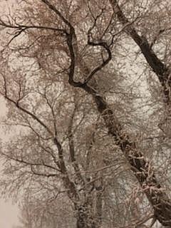
 However, the wind may be blowing snow. It isn't as bad as this from earlier on Thursday:
••• Due to the inclement weather anticipated by the National Weather Service, and in the interest of their safety, our delivery team may experience travel challenges and delays. To stay on top of breaking news, and to get the information you have come to trust from the Nevada Appeal, visit our website, download our app, follow us on social media and view our e-edition online. We’ll keep you up to date as the scenario unfolds. Plan ahead and leave yourself plenty of time, if you have to travel. Be sure to allow extra time to reach your destination.At some points during the day, it’s been snowing 4” an hour! ?: Asa Moore, Groomer at Squaw #mysquawalpine pic.twitter.com/3zKKp64PiF
- Squaw Alpine (@squawalpine) March 1, 2018
 •••
As the wind picks up nearing the 9 p.m. hour in Carson City, the National Weather Service predicts blizzard like conditions soon and into the overnight hours. Snow accumulations of 2 to 5 inches are possible tonight. Above 5,000 feet 5 to 8 inches of snow is expected.
•••
In the last hour in Carson City, we have seen rain then snow then rain then snow and now back to a mix.
•••
As the wind picks up nearing the 9 p.m. hour in Carson City, the National Weather Service predicts blizzard like conditions soon and into the overnight hours. Snow accumulations of 2 to 5 inches are possible tonight. Above 5,000 feet 5 to 8 inches of snow is expected.
•••
In the last hour in Carson City, we have seen rain then snow then rain then snow and now back to a mix.
 In just a short span it is going from snow to rain. Be careful driving. Use caution and take extra time.

 The Winter Weather Advisory remains in effect from 4 p.m. this afternoon until 10 a.m. Friday. Snow accumlations of 2-to 6-inches with 6-12 inches expected above 5,000 feet.
Additional snow accumulations are possible Friday night. The heaviest snow is expected this afternoon and late this evening through early Friday, according to the National Weather Service.
The NWS says travel conditions, including the evening commute today and Friday morning commute could be impacted.
A winter storm warning began at 10 p.m. Wednesday and extends through 10 a.m. Saturday.
Storm watches and winter advisories also will be in effect for most of Northern Nevada, from Reno to the Utah state line during much of that time period as the biggest storm of the season makes its way across the region.
Avalanche danger will rise into the high category in the mountains around Lake Tahoe, where winds could gust up to 125 mph on the ridges and 40 to 60 mph in wind-prone valleys, the weather service said Wednesday.
"Strong winds will combine with very heavy snowfall rates to create dangerous, potentially life-threatening … whiteout conditions," the weather service in Reno said in a statement.
Travel will be difficult Thursday and Friday with damage to some trees and power lines likely, the service said.
"Even a short walk could be deadly if you become disoriented," the weather service said.
Anywhere from 2 to 5 feet of snow is expected in the upper elevations around Tahoe, with 1 to 3 feet at lake level.
A winter weather advisory runs from 4 p.m. today to 10 a.m. Saturday along the Sierra's eastern front, including Reno and Carson City where 2 to 5 inches is expected on the valley floors and up to 12 inches in the foothills
•••
Carson City roads and I-580 to Reno are clear as the storm appears stuck in the mountains.
The National Service is predicting dangerous blizzard conditions in the Lake Tahoe area today, with winds gusting over the ridge tops in excess of 100 mph. As much as 5 feet of new snow is expected to fall on upper elevations by the weekend.
A rare blizzard warning goes into effect at 8 a.m. today and runs through 4 a.m. Friday. A winter storm warning began at 10 p.m. Wednesday and extends through 10 a.m. Saturday.
Storm watches and winter advisories also will be in effect for most of Northern Nevada, from Reno to the Utah state line during much of that time period as the biggest storm of the season makes its way across the region.
Carson City's hourly forecast from The Weather Channel:
The Winter Weather Advisory remains in effect from 4 p.m. this afternoon until 10 a.m. Friday. Snow accumlations of 2-to 6-inches with 6-12 inches expected above 5,000 feet.
Additional snow accumulations are possible Friday night. The heaviest snow is expected this afternoon and late this evening through early Friday, according to the National Weather Service.
The NWS says travel conditions, including the evening commute today and Friday morning commute could be impacted.
A winter storm warning began at 10 p.m. Wednesday and extends through 10 a.m. Saturday.
Storm watches and winter advisories also will be in effect for most of Northern Nevada, from Reno to the Utah state line during much of that time period as the biggest storm of the season makes its way across the region.
Avalanche danger will rise into the high category in the mountains around Lake Tahoe, where winds could gust up to 125 mph on the ridges and 40 to 60 mph in wind-prone valleys, the weather service said Wednesday.
"Strong winds will combine with very heavy snowfall rates to create dangerous, potentially life-threatening … whiteout conditions," the weather service in Reno said in a statement.
Travel will be difficult Thursday and Friday with damage to some trees and power lines likely, the service said.
"Even a short walk could be deadly if you become disoriented," the weather service said.
Anywhere from 2 to 5 feet of snow is expected in the upper elevations around Tahoe, with 1 to 3 feet at lake level.
A winter weather advisory runs from 4 p.m. today to 10 a.m. Saturday along the Sierra's eastern front, including Reno and Carson City where 2 to 5 inches is expected on the valley floors and up to 12 inches in the foothills
•••
Carson City roads and I-580 to Reno are clear as the storm appears stuck in the mountains.
The National Service is predicting dangerous blizzard conditions in the Lake Tahoe area today, with winds gusting over the ridge tops in excess of 100 mph. As much as 5 feet of new snow is expected to fall on upper elevations by the weekend.
A rare blizzard warning goes into effect at 8 a.m. today and runs through 4 a.m. Friday. A winter storm warning began at 10 p.m. Wednesday and extends through 10 a.m. Saturday.
Storm watches and winter advisories also will be in effect for most of Northern Nevada, from Reno to the Utah state line during much of that time period as the biggest storm of the season makes its way across the region.
Carson City's hourly forecast from The Weather Channel:
 ••••
Snow is starting to stick to the Lake View Hill area of I-580 as of 8:30 a.m. I-580 through Washoe Valley is still clear but as commuters leave or arrive into Carson City, snow is starting to stick.
A view from the Nevada Department of Transportation's cameras.
••••
Snow is starting to stick to the Lake View Hill area of I-580 as of 8:30 a.m. I-580 through Washoe Valley is still clear but as commuters leave or arrive into Carson City, snow is starting to stick.
A view from the Nevada Department of Transportation's cameras.
 Current road conditions:
 A current screenshot of the Weather Channel's radar:
 •••
As of 7:30 this morning, Carson City roads were clear. The storm is starting to leave moisture in Washoe Valley and the Galena Creek Bridge area. I-580 is still flowing with no controls this morning. If you are headed to the lake, chain and snow tires are required.
•••
As of 7:30 this morning, Carson City roads were clear. The storm is starting to leave moisture in Washoe Valley and the Galena Creek Bridge area. I-580 is still flowing with no controls this morning. If you are headed to the lake, chain and snow tires are required.
 •••
As of 6:30 this morning, Carson City roads were clear but the storm was moving in from the west.
Here are current road conditions, be sure to check http://nvroads.com/ for more information.
•••
As of 6:30 this morning, Carson City roads were clear but the storm was moving in from the west.
Here are current road conditions, be sure to check http://nvroads.com/ for more information.
 There's an 85 percent chance of light snow in Carson City between now 7 a.m. At 7 a.m. the National Weather Service predicts rain and wind for the rest of the morning.
 Incline Village schools are canceled for today as the storm has dropped a significant amount of snow at the lake, as seen in this screen shot taken of the Nevada Department of Transportation's Mt. Rose Summit camera.
 The National Service is predicting dangerous blizzard conditions in the Lake Tahoe area today, with winds gusting over the ridge tops in excess of 100 mph. As much as 5 feet of new snow is expected to fall on upper elevations by the weekend.
A rare blizzard warning goes into effect at 8 a.m. today and runs through 4 a.m. Friday. A winter storm warning began at 10 p.m. Wednesday and extends through 10 a.m. Saturday.
Storm watches and winter advisories also will be in effect for most of Northern Nevada, from Reno to the Utah state line during much of that time period as the biggest storm of the season makes its way across the region.
Avalanche danger will rise into the high category in the mountains around Lake Tahoe, where winds could gust up to 125 mph on the ridges and 40 to 60 mph in wind-prone valleys, the weather service said Wednesday.
"Strong winds will combine with very heavy snowfall rates to create dangerous, potentially life-threatening … whiteout conditions," the weather service in Reno said in a statement.
Travel will be difficult Thursday and Friday with damage to some trees and power lines likely, the service said.
"Even a short walk could be deadly if you become disoriented," the weather service said.
Anywhere from 2 to 5 feet of snow is expected in the upper elevations around Tahoe, with 1 to 3 feet at lake level.
A winter weather advisory runs from 4 p.m. today to 10 a.m. Saturday along the Sierra's eastern front, including Reno and Carson City where 2 to 5 inches is expected on the valley floors and up to 12 inches in the foothills
The National Service is predicting dangerous blizzard conditions in the Lake Tahoe area today, with winds gusting over the ridge tops in excess of 100 mph. As much as 5 feet of new snow is expected to fall on upper elevations by the weekend.
A rare blizzard warning goes into effect at 8 a.m. today and runs through 4 a.m. Friday. A winter storm warning began at 10 p.m. Wednesday and extends through 10 a.m. Saturday.
Storm watches and winter advisories also will be in effect for most of Northern Nevada, from Reno to the Utah state line during much of that time period as the biggest storm of the season makes its way across the region.
Avalanche danger will rise into the high category in the mountains around Lake Tahoe, where winds could gust up to 125 mph on the ridges and 40 to 60 mph in wind-prone valleys, the weather service said Wednesday.
"Strong winds will combine with very heavy snowfall rates to create dangerous, potentially life-threatening … whiteout conditions," the weather service in Reno said in a statement.
Travel will be difficult Thursday and Friday with damage to some trees and power lines likely, the service said.
"Even a short walk could be deadly if you become disoriented," the weather service said.
Anywhere from 2 to 5 feet of snow is expected in the upper elevations around Tahoe, with 1 to 3 feet at lake level.
A winter weather advisory runs from 4 p.m. today to 10 a.m. Saturday along the Sierra's eastern front, including Reno and Carson City where 2 to 5 inches is expected on the valley floors and up to 12 inches in the foothills
Comments
Use the comment form below to begin a discussion about this content.
Sign in to comment