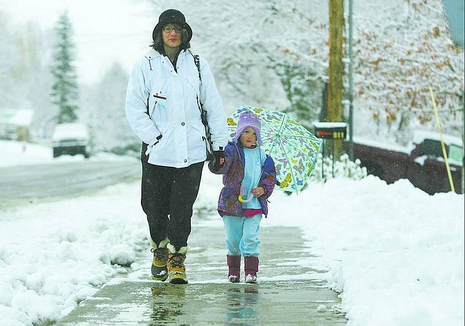
BRAD HORN/Nevada Appeal Sue Matuska and her daughter Emily, 4, of Carson City, walk home through the fresh snow after dropping a car off for repairs Friday morning.
Capital city residents awoke this morning to a blanket of snowfall and spent their day braving intermittent flakes, gusty winds and cold temperatures.
The city received about one-quarter inch of snow overnight before being hit with southeasterly winds gusting to between 18 and 30 mph, according to the National Weather Service in Reno.
Lake Tahoe was under a winter storm warning for most of the day Friday, with almost a foot of snow expected to fall above 7,000 feet. A chance of snow is forecasted for the lake through the middle of next week with temperatures ranging from highs in the 40s to lows in the teens.
The weather contributed to several accidents on Carson City roads Friday, including one involving a semi-truck hauling lumber on Highway 395 near Lakeview Road just after 1 p.m. Friday. The highway was briefly closed to allow for cleanup after the truck collided with a concrete barrier and lost its load into traffic.
At around the same time, there was a two-car accident at Roop and William streets that slowed traffic at the intersection for nearly a half-hour. The three occupants were transported to Carson Tahoe Regional Medical Center with minor injuries, according to the Nevada Highway Patrol.
The weather service expects scattered snow showers to continue today with winds out of the south gusting up to 25 mph with temperatures in the low 40s. The next storm rolls into the area Sunday, bringing mostly cloudy skies and a 20 percent chance of rain overnight with 15 mph to 20 mph winds.
The rain could turn to snow overnight Sunday with Monday having mostly cloudy skies and temperatures in the 40s and an increased chance of snow as the day progresses.
"Monday night will be the main shot of snow which will be tapering off into Tuesday," meteorologist Scott McGuire said.
McGuire said that because of the likelihood that the precipitation will come in the form of snow, there is less concern about flooding as a result of this storm.
"Once is switches to snow, it's a stored form of precipitation and that helps lessen the danger of flooding a little," McGuire said.
-- Contact reporter Jarid Shipley at jshipley@nevadaappeal.com or 881-1217.

Comments
Use the comment form below to begin a discussion about this content.
Sign in to comment