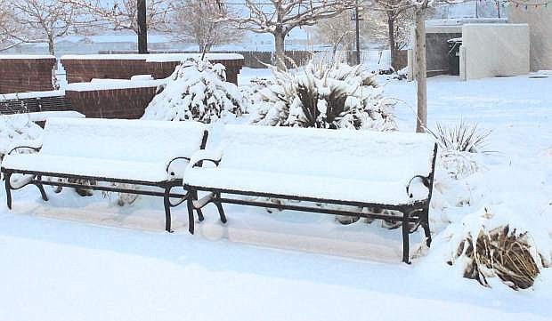
Snow covers a bench at Millennium Park.
A cold front sweeping across the Great Basin dumped more than a dusting of snow on central and northern Nevada.
Snow began falling in the Lahontan Valley shortly after 8 p.m. on Wednesday, and accumulations were reported from 3-4 inches or more in the city and 6 inches or more in the valley.
Fog was also reported in Churchill County and along the Truckee River for commuters heading into Reno.
The expected morning low, which was forecast at 31, dipped into the low 20s Thursday morning, causing slick roads and icy sidewalks. The wind picked up to 15 miles per hours with stronger gusts.
The National Weather Service said Fallon will be mostly sunny today with a high near 31 and calm winds. The low is predicted at 18.
Western Nevada, though, will have a nostalgic weekend with memories of flooding in 1996-1997. Flooding this time around is expected to affect Reno and Carson City beginning on Sunday.
A storm expected this weekend is being compared to a major storm 20 years ago that caused extensive flooding throughout western Nevada when warm rains melted the Sierra Nevada snowpack and sent water down the various tributaries. Water submerged the downtown Reno area next to the Truckee River, and parts of the airport were under water. Flooding also affected the low-lying areas of an industrial complex east of Sparks, causing extensive damage. Carson City also experienced flooding.
“Meteorologists are making the comparison because of the heavy snowfall and considerable snowpack in December 1996, which came before the 1997 ‘Pineapple Express’ or atmospheric river between Dec. 30 and New Year’s 1997,” said Stacey Belt, Carson City deputy emergency manager. “That rainfall in the mountains brought a lot of water down causing flooding across western Nevada. If predictions are accurate and the snow level is between 9,000 and 10,000 feet this coming Saturday, it’s a lot of moisture on top of the snowpack and it has to go somewhere.”
In late December 1996, the Sierra Nevada had a snowpack of more than 180 percent of normal.
Forecasters are calling for 6-12 inches of rain in the Sierra Nevada and Carson Range this weekend. In the Lahontan Valley, snow showers and freezing rain before noon on Saturday are expected. Chance of precipitation is 60 percent. Fallon, which could receive as much as 3 inches of rain over the weekend, could see some localized flooding, added the NWS.
The chance of flooding in Churchill County, though, is not great, reports the NWS.
The NWS said the Carson River will be moving at high flows, especially at Fort Churchill, but the water will run into Lahontan Reservoir; however, the NWS said low-lying areas along the river west of the reservoir could have minor flooding. The stretch between Smith’s in Dayton to Carson Plains, for example, experienced moderate flooding and water lapping up to U.S. Highway 50 during a strong winter system in 2005-06.
Additional reporting from Anne Knowles of the Nevada Appeal.

Comments
Use the comment form below to begin a discussion about this content.
Sign in to comment