The Nevada Traveler: When Nevada roads had colorful names and not just numbers
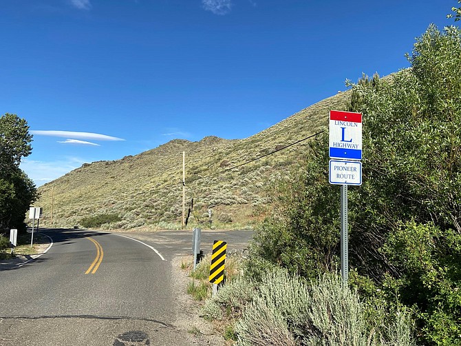
Traveler.jpg: The legendary Lincoln Highway, which followed the route (mostly) of today’s U.S. 50 across Nevada, is one of the named roadways that predated the numbered highway system.
Photo: NDOT
One of the best things about early roadways in America is that had descriptive names rather than boring old numbers. Interstate 80? Naw, it was the Victory Highway. U.S. 6 — the Grand Army of the Republic Highway. Often these colorfully named roads were either partially or entirely funded by the automobile manufacturers or private associations, who were interested in persuading people to buy automobiles and drive them on these new highways. Over time, as the automobile grew more popular, communities began to compete to attract travelers to travel on their highway and, it was hoped, stop in one of those cities and towns to spend a bit of money. By the mid-1920s, there were hundreds of these roadways with evocative names like “The Yellowstone Trail” (Boston to Seattle) and the “National Old Trails Road” (Baltimore to Los Angeles) — throughout the country, including through Nevada. It all started to come to an end in the late 1920s and into the 1930s when the federal government got into the roadway game and introduced a national numbered highway system to simplify road designations and eliminate some of the confusion for drivers. Vintage photographs illustrate this point, showing busy intersections with directional signs pointing in five or six directions — and, according to some accounts, some overzealous highway promoters were not above vandalizing rival road signs to keep drivers on their roads. While the tradition of naming highways hasn’t completely died out — in recent years U.S. 50 was named “the Loneliest Road in America” and Nevada State Route 375 is called “the Extraterrestrial Highway,” most people refer to the state’s highways by their shorter, numerical names like I-15 or 395. The following, however, are a few of the more descriptive names once associated with Nevada roadways:
The Lincoln Highway – The granddaddy of early highways in the state, the Lincoln Highway, which in Nevada roughly paralleled today’s U.S. 50, was America’s first coast-to-coast road. Stretching about 3,300 miles from Times Square in New York to San Francisco, the Lincoln Highway was established in 1913 and commemorated President Abraham Lincoln. According to an early guidebook, the purpose of the highway was to “promote and procure the establishment of a continuous improved highway from the Atlantic to the Pacific, open to lawful traffic of all descriptions without toll charges, and to be of concrete wherever practicable.”
The Victory Highway – A rival of the Lincoln Highway, the Victory Highway took a more northern route through Nevada, following the historic Emigrant Trail (today’s I-80). Later called U.S. 40, the Victory was one of several transcontinental routes that evolved prior to the 1920s to link the eastern U.S. to California.
The Grand Army of the Republic Highway – In the mid-1920s, this elegant title was bestowed on the route that crossed the center of the state from Benton, Calif. to the state line near Baker, Nev., today’s U.S. 6. The name commemorated the Union Army that fought in the Civil War.
The Midland Trail – Another name given to U.S. 6, the Midland Trail originally was known as the Cumberland Trail in the eastern U.S. The highway started in Washington D.C. and ended in Los Angeles. The name referred to the fact that the route passed through the middle portion of the country.
The Theodore Roosevelt Highway – Yet another former name for U.S. 6. This highway honored the 26th president and the name apparently was used until the late 1930s. The March-April 1939 issue of Nevada Highways and Parks magazine (now known as Nevada Magazine) noted that the “Roosevelt Highway enters Nevada from Delta, Utah, as an earth road.”
The Bonanza Highway – The Bonanza meandered along Nevada’s western edge following most of today’s U.S. 95. The highway, named because it passed through many of the state’s mining towns, including Tonopah and Goldfield, stretched from the Oregon border to Las Vegas.
The International Four States Highway – Quite a mouthful, this was an impressive name given to the route along Nevada’s eastern side (now U.S. 93). The total length of the road extended 1,500 miles from Canada to Mexico, through the states of Montana, Idaho, Nevada and California. Also called the Pan-Pacific Highway, the International Four States Highway was the longest highway in Nevada at more than 500 miles.
The Three Flags Highway – The Three Flags was a north-south arterial, which followed today’s U.S. 395. The name was derived from the fact that the route went from British Columbia, Canada to the Mexican border, passing through three countries.
The Arrowhead Trail – This highway crossed the southern part of the state along the path of today’s I-15 (which was earlier known as U.S. 91). An historic marker at Valley of Fire State Park notes that the road was built in 1914-15 as an all-weather route linking Salt Lake City to Los Angeles. Conceived by Las Vegas promoters, it was supported by local chambers of commerce from communities along the trail and built by volunteers.
The National Shortcut Highway – This is certainly a case where the name says it all. This highway provided a direct link between Omaha, Nebraska and Las Vegas. Like the Arrowhead Trail, it mostly followed the route of today’s I-15.
The Winnemucca-to-the-Sea Highway – In the 1960s, Winnemucca citizens revived the custom of naming roads when they gave this sobriquet to the completed highway, via State Route 140, from Winnemucca to the coastal town of Crescent City, Calif. In commemoration, a sizable redwood-tree slab stands in front of the convention center where the Winnemucca-to-the-Sea route meets the old Victory Highway.
For a more complete history of American roadways with names, check out the Federal Highway Administration’s webpage devoted to “Highway History,” at www.fhwa.dot.gov/infrastructure/numbers.cfm.
Rich Moreno writes about the places and people that make Nevada special.
Comments
Use the comment form below to begin a discussion about this content.

Comments
Use the comment form below to begin a discussion about this content.
Sign in to comment