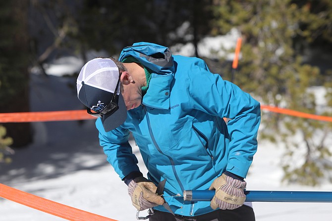
Hydrologist Bill Anderson of the Natural Resources Conservation Service checks the bottom of a cylinder for snow and dirt before weighing the content.
Steve Ranson / LVN
 Steve Ranson/LVN
 Steve Ranson/LVN
 Steve Ranson/LVN
 Steve Ranson/LVN

Comments
Use the comment form below to begin a discussion about this content.
Sign in to comment