The National Weather Service says rain and snow showers should arrive in Carson City by Thursday afternoon and has issued a freeze warning for Friday morning.
Temperatures Thursday night through Friday morning in Carson City, Douglas, Lyon and Storey counties are forecast as low as the middle 20s and the snow level could drop to 4,600 feet (the NWS lists Carson City’s elevation at 4,717 feet).
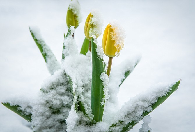
Rain and snow showers, wind and unseasonably cold temperatures are forecast through the weekend.
The NWS freeze warning said low temperatures Friday morning are forecast between 26 and 35 degrees. The coldest temperatures will occur in rural or suburban valleys.
“Take steps to protect tender plants from the cold,” the NWS said. “To prevent freezing and possible bursting of outdoor water pipes they should be wrapped, drained, or allowed to drip slowly. Those that have in-ground sprinkler systems should drain them and cover above-ground pipes to protect them from freezing.”
In a special weather statement, the NWS said showers and strong winds will develop Thursday afternoon as “an unusually strong cold front will dive into the region.”
Gusts in wind prone spots could reach 60 mph through early Thursday afternoon. “This would be hazardous for high profile vehicles (and) produce fire weather concerns in areas of the Eastern Sierra where vegetation is already dry,” the NWS said.
Rain and snow showers are expected to develop over most areas by Thursday afternoon, with even isolated thunderstorms possible, producing pellets and lightning. Heavier snow showers, especially those in the mountains, could result in sudden slick roadways and traffic incidents. This rain and snow shower pattern will likely occur again Friday and Saturday. Even overnight snow showers cannot be ruled out and these may produce a dusting of snow even at lower elevations.
“High temperatures will be more reminiscent of what we might see in February or early March,” the NWS said.
Freezes are possible again Saturday morning.
For information, go to weather.gov.
The Forecast
Thursday: Rain showers before 4 p.m., then rain and snow showers. Some thunder is also possible. High near 53. Breezy, with a west wind 15 to 20 mph becoming northwest in the afternoon. Winds could gust as high as 30 mph. Chance of precipitation is 80%. Little or no snow accumulation expected.
Thursday night: Scattered rain and snow showers before 3 a.m., then snow showers likely. Some thunder is also possible. Snow level 5,000 feet lowering to 4,600 feet after midnight. Mostly cloudy, with a low around 31. Northwest wind 5 to 15 mph, with gusts as high as 25 mph. Chance of precipitation is 60%. New snow accumulation of less than a half inch possible.
Friday: Scattered snow showers before 9 a.m., then a slight chance of rain and snow showers between 9 a.m. and 11 a.m., then rain showers likely after 11 a.m. Some thunder is also possible. Snow level rising to 5,700 feet in the afternoon. Cloudy, then gradually becoming mostly sunny, with a high near 55. North wind 5 to 15 mph, with gusts as high as 25 mph. Chance of precipitation is 60%. New snow accumulation of less than a half inch possible.
Friday night: Scattered showers and thunderstorms before 11 p.m. Snow level 6,100 feet. Mostly cloudy, with a low around 32. North wind 10 to 15 mph becoming west 5 to 10 mph in the evening. Winds could gust as high as 25 mph. Chance of precipitation is 40%.
Saturday: Isolated showers, then scattered showers and thunderstorms after 11 a.m. Snow level 5,600 feet rising to 6,800 feet in the afternoon. Mostly cloudy, with a high near 57. Light west wind becoming northwest 5 to 10 mph in the afternoon. Chance of precipitation is 50%.
Saturday night: Scattered showers and thunderstorms before 11 p.m. Snow level 7,200 feet. Mostly cloudy, with a low around 36. West wind 5 to 10 mph. Chance of precipitation is 30%.
Sunday: A 20 percent chance of showers. Snow level 6,900 feet rising to 8,100 feet in the afternoon. Mostly sunny, with a high near 66.
Sunday night: Mostly clear, with a low around 39.
Monday: Sunny, with a high near 75.

Comments
Use the comment form below to begin a discussion about this content.
Sign in to comment