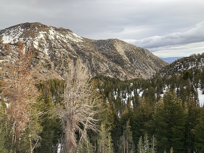
Mount Rose is seen to the left.
There’s only a short window of time to hike the high peaks around Tahoe without snow. I wanted to do one big peak for 2021 before the snow arrives and makes it too difficult. On a day when many decided to stay inside due to the chilly weather, I ventured out in hopes of climbing Mount Rose.
Mount Rose is popular for several reasons. It is the third tallest peak in the Tahoe Basin at 10,776 feet. There’s views of Reno and Lake Tahoe. The trailhead is easily accessible with a large parking area between Lake Tahoe and Reno near the Mount Rose Ski Area. There’s also a few other hikes and a waterfall nearby, so there can be quite a few visitors in a day.
On a chilly November morning, I was the first person on the trail. The drive going up Mount Rose Highway was majestic as the sunlight started illuminating the environment. I arrived at the parking area right at sunrise, about 7:34 a.m. the day before Daylight Saving.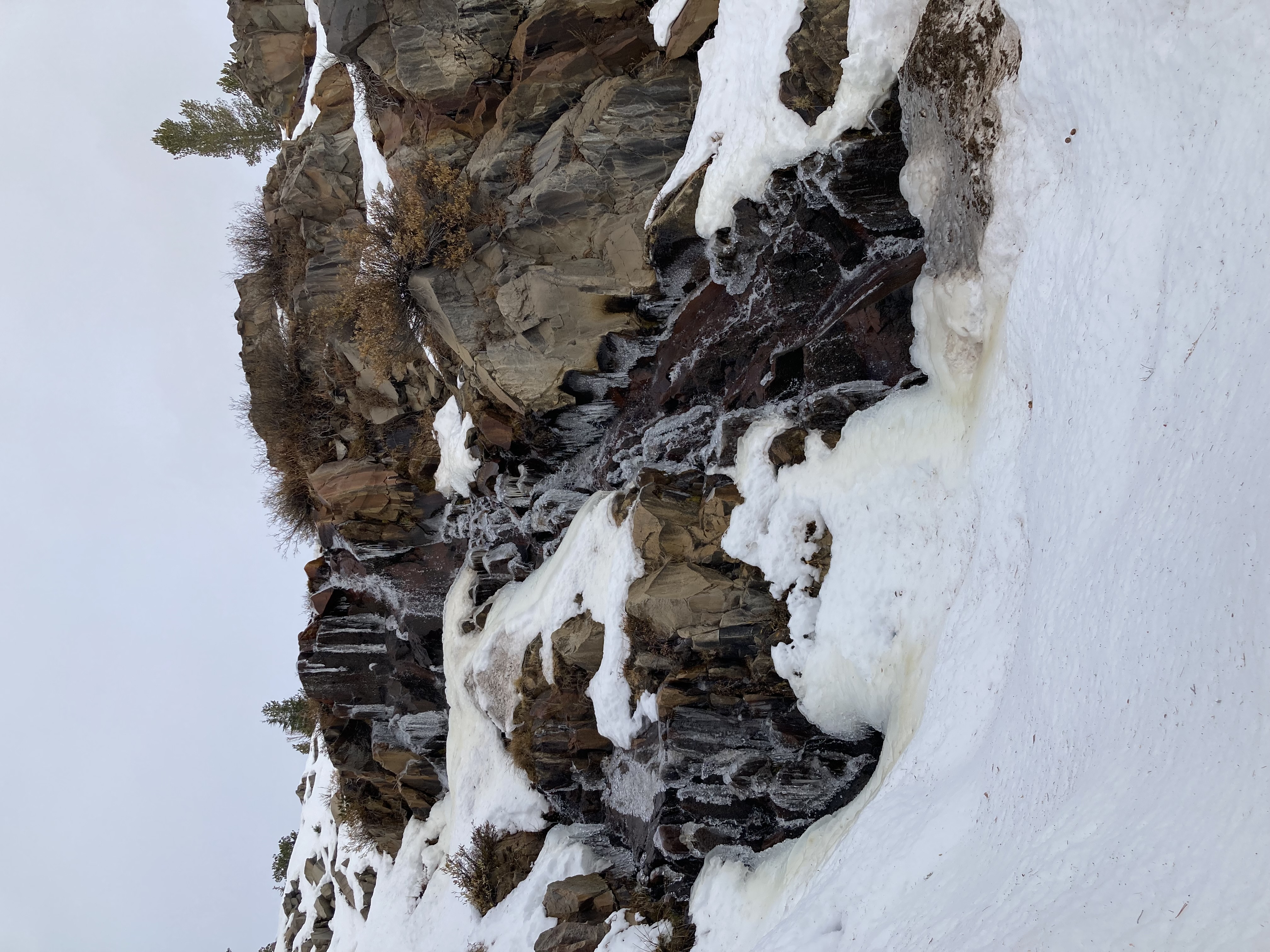 Galena Falls is located about halfway to Mount Rose at around 2.5 miles. (Photo: Kyler Klix/Nevada Appeal)
 The trail started out with some gradual elevation gain. There are tremendous views of Lake Tahoe with the mountains toward the west right away. It’s the kind of spot that slows you down if you like taking pictures.
We already had one storm this year, so it was probable there would be snow and ice on the trail. A recent purchase of some ice cleats helped solve that problem. About a mile into the trail, I put them on for most of the way and ended up hiking at least 8 of the 10 miles in the ice cleats.
The snow was only a couple feet high, and people had already walked on it in previous days, packing it down. With the cold morning temperature, it was easy walking on top of it all. On the way back, the sun warmed up the snow a bit making it softer. Snowshoes might’ve made that part easier, but it wasn’t too difficult to get through.
The next couple miles through the trees are very pleasant. There are great views, and the wind is blocked for part of the way. It’s a gradual hike down that leads to a valley, and at about 2.5 miles there’s the Galena Creek Waterfall. This waterfall looks beautiful in the snow. The water came rushing over the rocks and the edges were lined with ice. This is a popular spot, and many might turn around and head back from here, instead of continuing toward Mount Rose. There are also a couple intersections here from other trails.
Continuing toward Mount Rose, this is where the trail starts to climb in elevation more steadily.
This day in November there was a small storm coming in. Shortly after I got past the waterfall, the storm slowly moved in. The clouds obscured the view and the wind picked up. The precipitation that fell was closer to snow than ice, but it wasn’t thick and wasn’t sticking.
I had to follow the tracks of those who hiked previously because there was no chance of seeing the trail under the couple feet of snow already there.
I followed these tracks straight up the mountain and it felt like a Stairmaster. With the thinner air at the higher elevation, your breath gets taken away easily. I’d do 8-minute bursts of climbing and then have to take a short break for 4 minutes. I missed a left turn that led to a switchback and would’ve made the last bit much easier, so I continued straight up the steep clearing. I found the switchback coming back from the top.
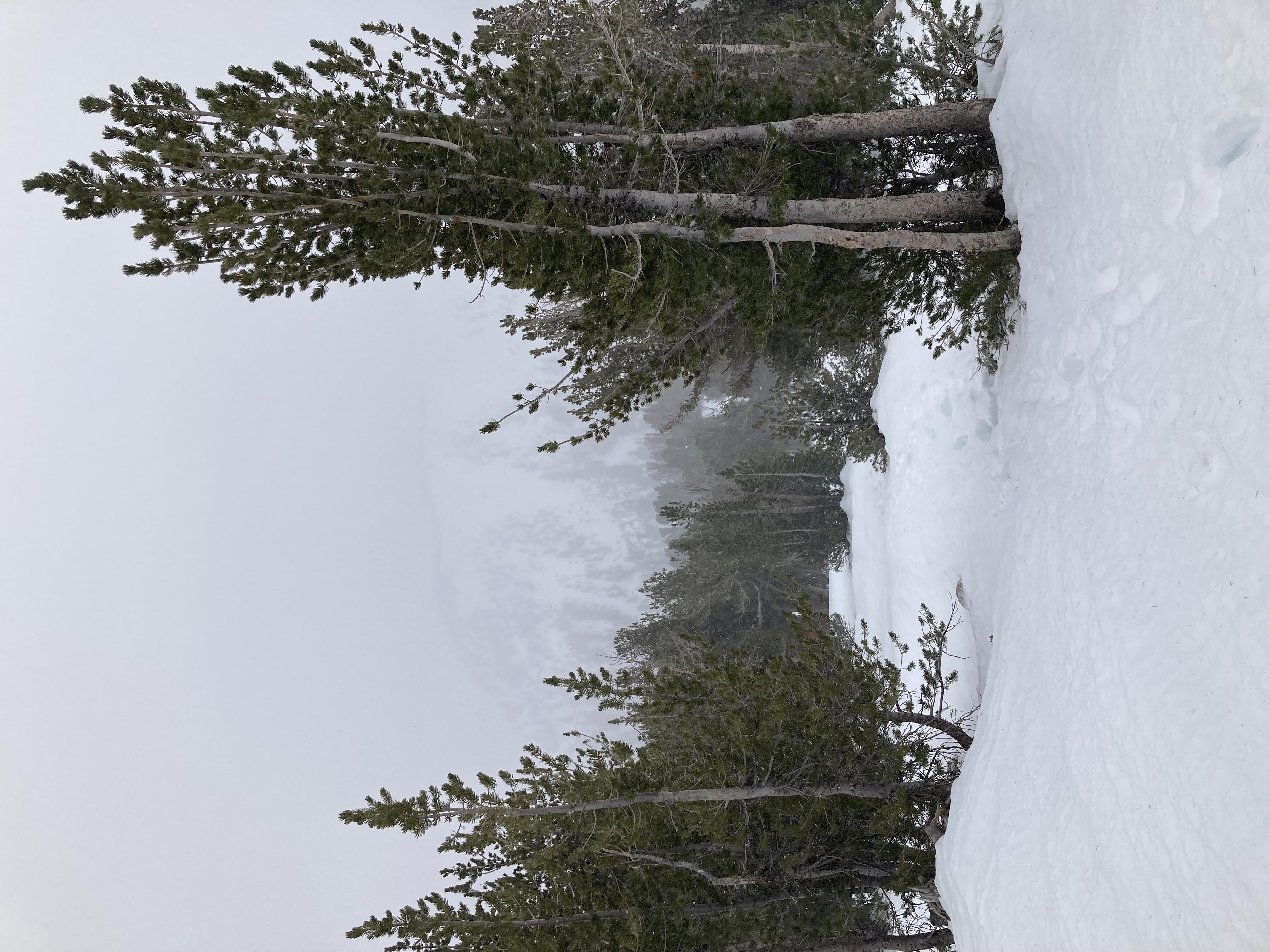 The trail is covered with snow and a storm moving in brought some wintry conditions on Mount Rose. (Photo: Kyler Klix/Nevada Appeal)
Once past the tree line, the wind was almost unbearable. The summit was completely rocky. There was not much chance of life up there and those conditions showed why. The wind was probably blowing about 60 mph and the frozen precipitation falling made it rough on any exposed skin.
There weren’t any views on this day as the storm surrounded the mountain. It was very blustery at the top and kind of scary. I sat behind a big rock for about 2 minutes before I couldn’t take it anymore.
Finding the trail down was much easier from the top where there was no snow sticking. It led me right back to the spot where I should’ve turned left, and I followed tracks the rest of the way down.
Then when the tracks started to look like they weren’t going the way I was supposed to, I checked the map on my phone and found that I was a little off the trail. It was easy to head where I needed to go and find my way.
Due to the weather, this was the latest in the season that I would do a hike of this kind. As it gets colder, proper gear will be needed like an avalanche beacon and possibly snowshoes. Make sure you are familiar with the proper guidelines for winter hiking before you attempt it. There is much more danger involved in cold-weather hiking
In your travels, always remember to respect nature and other hikers. Leave no trace; pack out what you packed in.
Kyler Klix is a designer for Nevada News Group. He also writes about the outdoors and entertainment. Email him at kklix@nevadanewsgroup.com.

Comments
Use the comment form below to begin a discussion about this content.
Sign in to comment