Water from Friday’s rainstorm pooled up along curbs throughout certain parts of Fallon.
Photo by Steve Ranson.
October has come in with a crack, snapple and pop with the area’s first major storm to begin a new water year.
The first measurable precipitation was recorded from a Friday morning storm that flowed across portions of Northern Nevada.
A major storm cell hovered over Churchill County shortly after 8 a.m. with a brief but impressive display of thunder and lightning followed by a downpour. The National Weather Service measured a half-inch of rain at the University of Nevada ag station across U.S. Highway 95 south from the fairgrounds and 0.44 of an inch at Naval Air Station Fallon.
The quick accumulation of rain also flooded several intersections throughout the city. The U.S. Drought Monitor has not budged since the spring with central. Nevada showing severe-drought conditions.
While the lower elections received rain, the higher elections received a dusting of snow.
After a picturesque fall weekend that provided good weather for the annual downtown car show, Mother Nature teased western Nevada with snow and sleet Monday morning. Chains or snow tires were required on the Mount Rose and Comstock highways, and the commute for Churchill County drivers to the Tahoe Reno Industrial Center, Reno and Carson City was messy. Temperatures on Monday hovered near freezing for most of the morning.
Temperatures, though, are expected to climb to 70 by week’s end.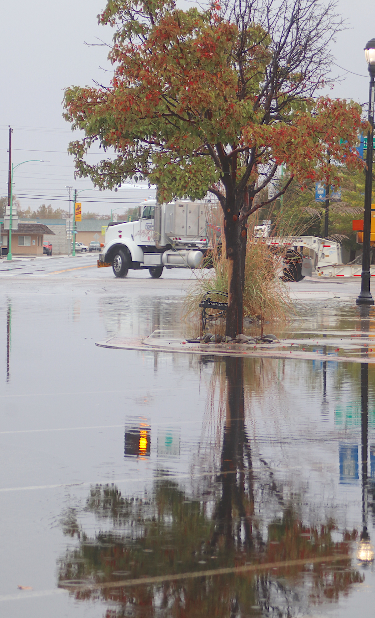 Steve Ranson / LVN
A tree’s reflection reflects off the water on Northern Maine Street during Friday’s rainstorm.
The cooler weather that the area has experienced for the past month has been a respite from a brutal summer when Churchill County endured a record-setting three dozen days of 100 degrees and more.
The National Weather Service recorded 36 days of 100-degree plus days spread out over a four-month period. The western part of the county had five straight days where the temperature rose above the century mark with two days, June 28-29, breaking the all-time record with 105 degrees.
July emerged as a scorcher with 11 straight days of 100-degree and above normal temperatures. The all-time record of 108 degrees was broken when the temperature soared to 109 degrees on July 11 and then again on the following day. August had nine days of 100-degree or plus temperatures, and on Aug. 16, the all-time high for that day was shattered when the weather service recorded 105 degrees. The weather began to cool down in September, but Sept. 9 finished the day at 101 degrees.
In reviewing previous year’s records, the Lahontan Valley News reviewed more than 40 years of records, and the closest year to 2021 in terms of 100-degree or higher days came in 2017. June recorded five days of 100-degree or more days followed by nine in July and eight in August.


Comments
Use the comment form below to begin a discussion about this content.
Sign in to comment