AdobeStock
With heavy snow accumulations predicted for valley floors this weekend, residents are encouraged to prepare.
The American Red Cross of Northern Nevada urges residents to prepare and avoid the outdoors during the storm.
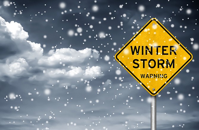
Northern Nevada is being slammed by high winds today ahead of a Winter Storm Warning issued by the National Weather Service.
A winter storm warning takes effect at 10 p.m. Thursday and continues through 10 p.m. Saturday. A high wind warning remains in place until 10 p.m. Thursday.
Experts predict some parts of the state could see wind speeds as high as 80 mph today, bringing 6-14 inches of snow on the valley floors, and 1-2 feet in Virginia City by Saturday night.
Before the storm arrives:
• Listen to local media for information and updates
• Be prepared to evacuate if loss of power creates a dangerous situation
• Check your emergency kit and replenish any items missing or in short supply
• Be sure you have ample heating fuel
• If you have alternative heating sources, such as fireplaces, wood or coal-burning stoves or space heaters, be sure they are clean and in working order
Check your emergency kit for essentials
• Food items: water, non-perishable items like packaged granola bars and snacks
• First-aid items: antiseptic wipes, bandages, gauze, hand sanitizer
• Warming items: emergency blankets, hand warmers, rain ponchos
• Emergency alert items: flashlight, light stick, hand-held radio, portable phone charger
• Car care items: portable battery jump-starter, foldable shovel, spare tire and changing tools
Emergency Supply Checklist: https://dem.nv.gov/uploadedFiles/demnvgov/content/Resources/FINAL%20Emergency%20Supply%20Kit.pdf
Emergency Alert Notifications: https://dem.nv.gov/preparedness/Emergency_Alerts/
Nevada road conditions are available by calling 511 or go to nvroads.com. California road conditions are available at 800-427-7623 or go to quickmap.dot.ca.gov.
For information, visit www.redcross.org.
For motorists traveling over the Sierra, a blizzard warning has been issued through Sunday. Falling and blowing snow with strong winds are likely. This will lead to whiteout conditions, making travel extremely dangerous, according to the National Weather Service. Do not travel. If you must travel, have a winter survival kit with you. If you get stranded, stay in your vehicle.
CARSON CITY FORECAST
THURSDAY: Rain, mainly after 10 a.m. Snow level 6,300 feet. High near 52. Windy, with a southwest wind 15 to 20 mph increasing to 25 to 30 mph in the afternoon. Winds could gust as high as 55 mph. Chance of precipitation is 80%.
THURSDAY NIGHT: Rain before 10 p.m., then snow likely. Low around 32. Breezy, with a southwest wind 20 to 25 mph, with gusts as high as 45 mph. Chance of precipitation is 80%. New snow accumulation of less than a half inch possible.
FRIDAY: Snow. High near 43. Breezy, with a southwest wind 20 to 25 mph, with gusts as high as 40 mph. Chance of precipitation is 80%. New snow accumulation of less than one inch possible.
FRIDAY NIGHT: Snow. The snow could be heavy at times. Patchy blowing snow after 11 p.m. Low around 29. Breezy, with a southwest wind 20 to 25 mph, with gusts as high as 40 mph. Chance of precipitation is 90%. New snow accumulation of 3 to 5 inches possible.
SATURDAY: Snow. The snow could be heavy at times. Areas of blowing snow before noon. High near 37. Breezy, with a southwest wind 20 to 25 mph, with gusts as high as 40 mph. Chance of precipitation is 90%. New snow accumulation of 3 to 7 inches possible.
SATURDAY NIGHT: Snow, mainly before 10 p.m. Low around 21. Breezy, with a west wind 15 to 20 mph, with gusts as high as 30 mph. Chance of precipitation is 80%. New snow accumulation of 2 to 4 inches possible.
SUNDAY: A 40 percent chance of snow. Partly sunny, with a high near 37. New snow accumulation of around an inch possible.
SUNDAY NIGHT: A chance of snow, mainly before 10 p.m. Mostly cloudy, with a low around 21.
MONDAY: Partly sunny, with a high near 42.
MONDAY NIGHT: A slight chance of snow. Mostly cloudy, with a low around 23.
TUESDAY: A slight chance of snow. Partly sunny, with a high near 44.
TUESDAY NIGHT: A slight chance of snow. Mostly cloudy, with a low around 23.
WEDNESDAY: A chance of snow. Partly sunny, with a high near 44.

Comments
Use the comment form below to begin a discussion about this content.
Sign in to comment