UPDATE:
Check nvroads.com before traveling.
Carson City has the tail end of a storm pushing through Tuesday and Wednesday, but residents can expect a break from the snow for New Year’s weekend.
The National Weather Service in Reno predicts 1-2 inches of snow Tuesday afternoon and evening, with lingering showers on Wednesday. Temperatures remain cold, with this week’s highs in the 30’s and single-digit lows.
New Year’s weekend from Thursday to Sunday is looking sunny with possible snow overnight.
This month, the Central Sierra Snow Lab reported their snowiest December, at just under 10 feet. According to the NWS, the Carson River Basin received 215 percent of its average snowfall. The Lake Tahoe Basin reached 228 percent of its average snowfall.
Despite traffic accidents and delays, “(The snow has been) very beneficial to the region,” an NWS representative in Reno told the Appeal.
He added that the NWS still encourages residents to travel with caution, despite sunny conditions this weekend. Mountain roads will still be snow-covered and slick, and residents working and recreating outdoors should expect cold temperatures.
The NWS representative said that Northern Nevada is eyeing another storm next week, but it’s too early to know whether it will reach the valley, blow farther north, or dissipate.
Tuesday
A 20 percent chance of snow before 1pm. Mostly cloudy, with a high near 34. Southwest wind around 5 mph.
Tuesday Night
Snow, mainly after 4am. Low around 22. Calm wind. Chance of precipitation is 80%. New snow accumulation of less than a half inch possible.
Wednesday
Snow, mainly before 4pm. High near 35. Calm wind becoming northeast around 5 mph in the morning. Chance of precipitation is 80%. New snow accumulation of less than one inch possible.
Wednesday Night
A 20 percent chance of snow before 10pm. Mostly cloudy, with a low around 17. Calm wind.
Thursday
Partly sunny, with a high near 37. Southwest wind 5 to 10 mph.
Thursday Night
A 20 percent chance of snow after 10pm. Mostly cloudy, with a low around 18. Southwest wind around 5 mph.
Friday
A 20 percent chance of snow. Mostly sunny, with a high near 34.
Friday Night
Mostly clear, with a low around 7.
Saturday – New Year's Day
Sunny, with a high near 34.
Saturday Night
Mostly clear, with a low around 10.
Sunday
Sunny, with a high near 38.
Sunday Night
A slight chance of snow. Partly cloudy, with a low around 17.
Monday
A chance of snow. Partly sunny, with a high near 42.
ORIGINAL:
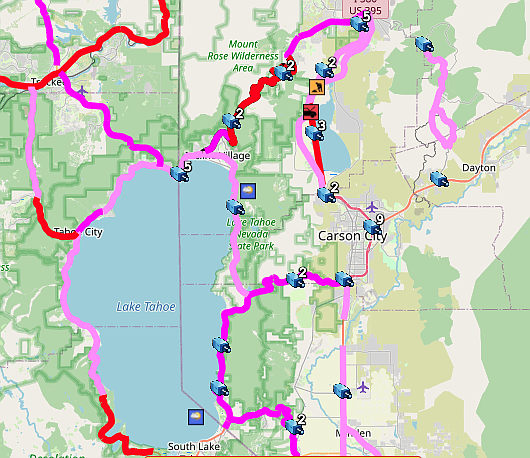
Carson City and Reno state government offices are on 2-hour delay Tuesday morning because of a winter storm that keeps producing in the Sierra Nevada.
Tuesday’s commute is marked by icy roads and light snow showers.
Check nvroads.com before traveling.
As of 6 a.m. I-580 through Washoe Valley was still closed.
Chain and snow tires are necessary on most major highways. Local roads in Carson City were snow and icy covered.
The light snow showers are expected to last today and Wednesday continuing Friday.
The storm was a record-breaker, pushing the December snowfall total for the Central Sierra Snow Lab to 193.7 inches, passing the previous record of 179-inches in 1970.

Comments
Use the comment form below to begin a discussion about this content.
Sign in to comment