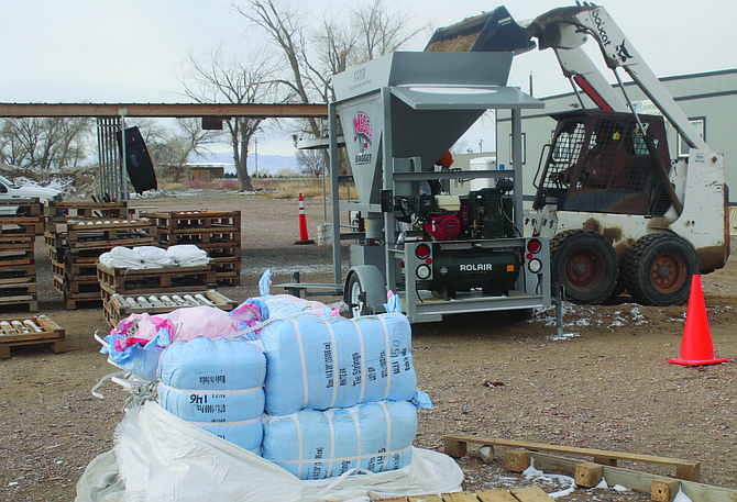
The Churchill County Road Department fills sandbags Monday morning at its Miners Road location.
Photo by Steve Ranson.
Water and emergency managers, along with government officials, are warning the water from the melting snowpack in the Sierra Nevada will significantly increase for the next four months.
Officials have been meeting every Thursday morning at the Truckee Carson Irrigation District to discuss predictions for the snowpack and runoff and to update water control plans. Based on the various forecasting models, the overall snow water equivalent in the Sierra Nevada is exceeding the equivalent of 1.1 million acre-feet of water.
The 1.1 million acre-feet of water equals a little more than three full Lahontan reservoirs.
In the Carson basin, the melting now will cause the Carson River to flow into the Lahontan Reservoir at similar levels recorded in 2017. Downstream from the Lahontan Dam, the Carson River also flows to the Diversion Dam where water is also diverted into the V-line canal.
The group also learned the release of water will increase to the V-line canal and the Carson River downstream from the Lahontan Dam. The models indicate at least 100,000 acre-feet of water will be released in April and then again in July, 200,000 acre-feet in May and 225,000 acre-feet in June.
The latest snow survey readings in the Sierra continue to show the snow water equivalent from the four major basins affecting the western part of the state are easily exceeding 200% with the Carson basin at 285% of median as of March 31.
According to the Natural Resources Conservation Service, current precipitation amounts in the Lake Tahoe, Truckee, Carson and Walker basins have already surpassed water year normals.
“The Carson and Walker basin snowpacks are poised to jump past 2017’s record setting peak snowpack amounts,” the NRCS stated in a media release.
The NRCS said the Carson basin snowpack along with Walker basin readings indicate the total could break 2017’s record-setting snowpack amounts.
“As more and more snow piles up in the mountains and less and less winter lies ahead, the level of certainty in streamflow forecast volumes increases,” said Jeff Anderson, NRCS Water Supply specialist. “All indications are for plentiful river flows this spring and summer. We’re optimistic prolonged snowmelt into summer should help meet irrigation demand and leave reservoirs with good carryover storage in the fall.”
The University of California Berkeley Central Sierra Snow Lab at Donner Lake has recorded the most snow in 70 years. More than 700 inches have fallen in the Sierra, short of the 812 inches that fell during the winter of 1952.
At the end of March, the Carson River basin is 282% of normal. The Walker River basin is at 298%. Lake Tahoe is at 240% and the Truckee at 226%. The Northern Great Basin is at 203%. Every basin in northeastern Nevada has exceeded 200% except for the Snake River at 169%.
Dan Lahde, Special Studies Division manager with the Bureau of Reclamation, said there is more than enough water to fill Lahontan Reservoir.
“In the Walker Basin, Topaz and Bridgeport Reservoirs are also expected to fill this season,” he added.
TCID has opened the weir and spillway on the V-Line canal. TCID and Churchill County began the construction of the emergency weir and spillway in March 2017 when the area faced a heavy runoff.
At a special meeting March 27, the Churchill County Commission approved construction of a second weir on the V-line near the original one.
Commission Chairman Bus Scharmann said doubling of the water flow from the V-line canal to the desert will help mitigate flooding along the river and canals.
Water is currently being channeled south from the V-line canal to the desert which includes the Navy’s Bravo 16 range used for training the Navy SEALs. From there the water veers to the southeast and flows under U.S. Highway 95 south to Carson Lake.
Meg Ragonese, the Nevada Department of Transportation’s public information officer in Carson City, said NDOT is working with TCID, Churchill County and other partners to identify any potential flooding impacts to Bafford Lane. Furthermore, she said NDOT will monitor the culverts under both U.S. Highways 95 south and 50 east.
To move the water from Carson Lake, volunteers, state and federal agencies dug a 17-mile channel in May 2017 that carried water from the Carson Lake to the Carson Sink via the Stillwater National Wildlife Refuge. Crews from TCID, Churchill County Road Department and the city of Fallon began digging a 60-foot wide, 15-foot deep channel to bring water from the Carson Lake area. The channel traversed four installed drainage culverts under U.S. Highway 50 two miles south of Wildes Road.
The following information was provided at the town hall meeting:
• Residents who are concerned with flooding are advised to walk around their property, construct berms if possible, and place sandbags at vulnerable points.
• Sandbags may be picked up from 485 Miners Road at the following times: Monday through Friday: 10 a.m. to noon and again from 12:30 p.m. to 2:30 p.m.; Saturdays and Sundays: 9 a.m. to 2 p.m. For seniors and residents with mobility issues who live on the Carson River, sandbag delivery is available by calling the call center at 775-867-5923.
• The water call center telephone number is 775-867-5923, and it will be staffed weekdays from 8 a.m. to 5 p.m.
• Important websites to remember:
City of Fallon: fallonnevada.gov
Churchill County: churchillcountynv.gov
Truckee River Operating Agreement (water reports): troa.net
Lahontan Valley News: nevadaappeal.com

Comments
Use the comment form below to begin a discussion about this content.
Sign in to comment