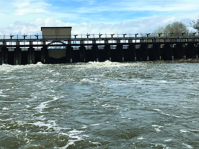
Water was released from Diversion Dam into the Carson River in March. Both the city and county terminated their respective state of emergency declarations at their July meetings.
Photo by Steve Ranson.
The city of Fallon and Churchill County have terminated their respective state of emergency declarations that were implemented in March due to the threat of flooding from the record snowpack in the Sierra Nevada.
Both governments issued a state of emergency due to the potential of flooding from the melting snowpack which was estimated to contain enough water to fill the equivalent of five, perhaps six, Lahontan reservoirs.
The city and county, along with the Truckee-Carson Irrigation District and Bureau of Reclamation, took immediate steps to mitigate any potential disaster by approving the construction of a big berm in the Carson Lake wetlands southeast of Fallon, a second weir on the V-Line canal and releasing additional water from the reservoir.
In a resolution dated July 14, Fallon Mayor Ken Tedford declared, “I find that emergency conditions no longer threaten the health, life, safety and welfare of personnel and property within the city.”
At their July 19 meeting, Churchill County Commissioners took similar action in their resolution.
“The extraordinary efforts of all county personnel were instrumental in ensuring no major property damage occurred due to the excess runoff, and their efforts are recognized,” the resolution stated.
According to the resolution, Lahontan Reservoir will be maintained between 290,000 to 300,000 acre-feet of water.
At their second meeting in March, Commission Chairman Bus Scharmann said the second weir was two-to-three times larger than the first weir, which was constructed during the spring of 2017 and located 50 feet downstream from the first weir. He said the second weir, which was finished in May, increased outflow from the current 750 cubic-feet-per-second off the V-line to 2,500 cfs.
Scharmann said doubling the flow of water from the canal to the desert helped mitigate flooding along the Carson River and canals.
Water from the V-line south from the weir and eventually veered southeast to cross under U.S. Highway 50 between the junction with Pasture Road (Nevada State Road 720) to about one-mile north of the turnoff for Top Gun Raceway.
Eventually, the water flows to Carson Lake and from were eventually channeled through a 17-mile long channel called the Big Dig to the Stillwater Wildlife Refuge. Implemented steps included the Churchill County Road Department and TCID cleaning out the Big Dig of debris and silt to allow water to flow more efficiently through the channel.
The road department built a berm along Pasture Road to a height of six feet to allow for increased water capacity in the Carson Lake by the end of March.

Comments
Use the comment form below to begin a discussion about this content.
Sign in to comment